
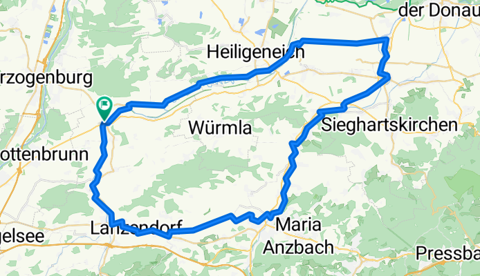
Perschlingtalradweg- Tullnradweg
A cycling route starting in Kapelln, Lower Austria, Austria.
Overview
About this route
- -:--
- Duration
- 62.1 km
- Distance
- 106 m
- Ascent
- 105 m
- Descent
- ---
- Avg. speed
- ---
- Max. altitude

Route quality
Waytypes & surfaces along the route
Waytypes
Road
19.3 km
(31 %)
Track
16.8 km
(27 %)
Surfaces
Paved
41 km
(66 %)
Unpaved
6.2 km
(10 %)
Asphalt
37.9 km
(61 %)
Gravel
4.3 km
(7 %)
Continue with Bikemap
Use, edit, or download this cycling route
You would like to ride Perschlingtalradweg- Tullnradweg or customize it for your own trip? Here is what you can do with this Bikemap route:
Free features
- Save this route as favorite or in collections
- Copy & plan your own version of this route
- Sync your route with Garmin or Wahoo
Premium features
Free trial for 3 days, or one-time payment. More about Bikemap Premium.
- Navigate this route on iOS & Android
- Export a GPX / KML file of this route
- Create your custom printout (try it for free)
- Download this route for offline navigation
Discover more Premium features.
Get Bikemap PremiumFrom our community
Other popular routes starting in Kapelln
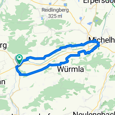
 JEUTENDORF Alte Perschling - Runde
- Distance
- 52.2 km
- Ascent
- 347 m
- Descent
- 347 m
- Location
- Kapelln, Lower Austria, Austria
 Aufeld 1, Etzersdorf nach Aufeld 20, Etzersdorf
- Distance
- 29.6 km
- Ascent
- 251 m
- Descent
- 252 m
- Location
- Kapelln, Lower Austria, Austria
 radfahrweg
- Distance
- 12.4 km
- Ascent
- 165 m
- Descent
- 153 m
- Location
- Kapelln, Lower Austria, Austria
 Kapelln/Altenwöhrt/ Traismauer
- Distance
- 54.4 km
- Ascent
- 153 m
- Descent
- 153 m
- Location
- Kapelln, Lower Austria, Austria
 Siofok Bike
- Distance
- 327.8 km
- Ascent
- 546 m
- Descent
- 682 m
- Location
- Kapelln, Lower Austria, Austria
 Perschlingtalradweg- Tullnradweg
- Distance
- 62.1 km
- Ascent
- 106 m
- Descent
- 105 m
- Location
- Kapelln, Lower Austria, Austria
 Rund um den Heiligenkreuzer Wald
- Distance
- 33.5 km
- Ascent
- 186 m
- Descent
- 191 m
- Location
- Kapelln, Lower Austria, Austria
 Kapelln
- Distance
- 17.9 km
- Ascent
- 166 m
- Descent
- 166 m
- Location
- Kapelln, Lower Austria, Austria
Open it in the app