Day 6 (part 2): Gais to St Gallen
A cycling route starting in Gais, Canton of Appenzell Ausserrhoden, Switzerland.
Overview
About this route
- -:--
- Duration
- 22 km
- Distance
- 261 m
- Ascent
- 498 m
- Descent
- ---
- Avg. speed
- ---
- Max. altitude
Route quality
Waytypes & surfaces along the route
Waytypes
Road
10.4 km
(47 %)
Quiet road
8.6 km
(39 %)
Surfaces
Paved
19.1 km
(87 %)
Asphalt
19 km
(86 %)
Paving stones
0.1 km
(<1 %)
Continue with Bikemap
Use, edit, or download this cycling route
You would like to ride Day 6 (part 2): Gais to St Gallen or customize it for your own trip? Here is what you can do with this Bikemap route:
Free features
- Save this route as favorite or in collections
- Copy & plan your own version of this route
- Sync your route with Garmin or Wahoo
Premium features
Free trial for 3 days, or one-time payment. More about Bikemap Premium.
- Navigate this route on iOS & Android
- Export a GPX / KML file of this route
- Create your custom printout (try it for free)
- Download this route for offline navigation
Discover more Premium features.
Get Bikemap PremiumFrom our community
Other popular routes starting in Gais
- Stoss-Kristallhöhle
- Distance
- 29.8 km
- Ascent
- 219 m
- Descent
- 691 m
- Location
- Gais, Canton of Appenzell Ausserrhoden, Switzerland
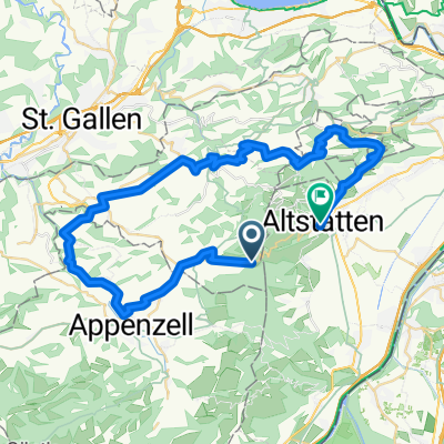
- E6: GAIS Bahnhof - ABTWIL Säntispark
- Distance
- 26 km
- Ascent
- 405 m
- Descent
- 682 m
- Location
- Gais, Canton of Appenzell Ausserrhoden, Switzerland
- vac j5
- Distance
- 54.2 km
- Ascent
- 1,171 m
- Descent
- 1,344 m
- Location
- Gais, Canton of Appenzell Ausserrhoden, Switzerland
- Gais (AR) - Appenzell (AI) - St. Gallen (SG)
- Distance
- 23.6 km
- Ascent
- 317 m
- Descent
- 579 m
- Location
- Gais, Canton of Appenzell Ausserrhoden, Switzerland
- A - Route 2 - Gäbris 36 km
- Distance
- 35.6 km
- Ascent
- 713 m
- Descent
- 703 m
- Location
- Gais, Canton of Appenzell Ausserrhoden, Switzerland
- Hohe Hirschbergstrasse 58, Appenzell Meistersrüte nach Marktgasse 4, Altstätten
- Distance
- 15.1 km
- Ascent
- 101 m
- Descent
- 779 m
- Location
- Gais, Canton of Appenzell Ausserrhoden, Switzerland
- Eggerstanden - Kamor - Bollenwees - Appenzell
- Distance
- 38.9 km
- Ascent
- 1,192 m
- Descent
- 1,300 m
- Location
- Gais, Canton of Appenzell Ausserrhoden, Switzerland
- Hirschberg Runde
- Distance
- 19.3 km
- Ascent
- 1,011 m
- Descent
- 1,009 m
- Location
- Gais, Canton of Appenzell Ausserrhoden, Switzerland
Open it in the app