

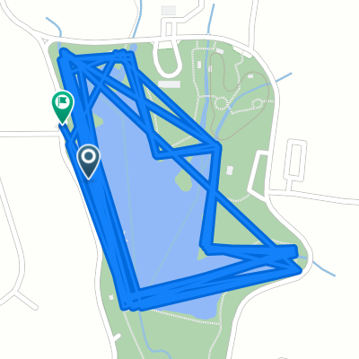
Lawrence ks to junction Texas
A cycling route starting in Ada, Oklahoma, United States.
Overview
About this route
- -:--
- Duration
- 728.2 km
- Distance
- 1,003 m
- Ascent
- 789 m
- Descent
- ---
- Avg. speed
- ---
- Max. altitude

Route quality
Waytypes & surfaces along the route
Waytypes
Quiet road
399.3 km
(55 %)
Busy road
157.3 km
(22 %)
Surfaces
Paved
79.6 km
(11 %)
Unpaved
49.7 km
(7 %)
Paved (undefined)
51.6 km
(7 %)
Gravel
47.3 km
(6 %)
Continue with Bikemap
Use, edit, or download this cycling route
You would like to ride Lawrence ks to junction Texas or customize it for your own trip? Here is what you can do with this Bikemap route:
Free features
- Save this route as favorite or in collections
- Copy & plan your own version of this route
- Split it into stages to create a multi-day tour
- Sync your route with Garmin or Wahoo
Premium features
Free trial for 3 days, or one-time payment. More about Bikemap Premium.
- Navigate this route on iOS & Android
- Export a GPX / KML file of this route
- Create your custom printout (try it for free)
- Download this route for offline navigation
Discover more Premium features.
Get Bikemap PremiumFrom our community
Other popular routes starting in Ada
 N Country Club Rd, Ada to Timber Terrace Dr, Ada
- Distance
- 2.6 km
- Ascent
- 25 m
- Descent
- 10 m
- Location
- Ada, Oklahoma, United States
 Doubtlyns house!
- Distance
- 5.2 km
- Ascent
- 29 m
- Descent
- 30 m
- Location
- Ada, Oklahoma, United States
 Lawrence ks to junction Texas
- Distance
- 728.2 km
- Ascent
- 1,003 m
- Descent
- 789 m
- Location
- Ada, Oklahoma, United States
 Mayfair Way, Ada to Timber Terrace Dr, Ada
- Distance
- 7.1 km
- Ascent
- 74 m
- Descent
- 62 m
- Location
- Ada, Oklahoma, United States
 iron man swim day training
- Distance
- 67.9 km
- Ascent
- 431 m
- Descent
- 459 m
- Location
- Ada, Oklahoma, United States
 Wintersmith Dr, Ada to Wintersmith Dr, Ada
- Distance
- 15.1 km
- Ascent
- 111 m
- Descent
- 105 m
- Location
- Ada, Oklahoma, United States
 Mayfair Way, Ada to Timber Terrace Dr, Ada
- Distance
- 7.5 km
- Ascent
- 167 m
- Descent
- 164 m
- Location
- Ada, Oklahoma, United States
 Ada to Scenic Dr, Ada
- Distance
- 20.6 km
- Ascent
- 65 m
- Descent
- 64 m
- Location
- Ada, Oklahoma, United States
Open it in the app