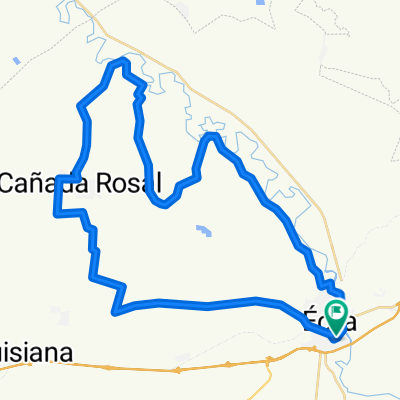
8 ETAPA CARR-CCCS2019
A cycling route starting in Écija, Andalusia, Spain.
Overview
About this route
ECIJA - HERRERA - CASARICHE - BADOLATOSA - PUENTE GENIL - HERRERA - MARINALEDA - ECIJA
- -:--
- Duration
- 115.9 km
- Distance
- 575 m
- Ascent
- 576 m
- Descent
- ---
- Avg. speed
- ---
- Avg. speed
Route quality
Waytypes & surfaces along the route
Waytypes
Road
62.4 km
(54 %)
Busy road
39 km
(34 %)
Surfaces
Paved
6 km
(5 %)
Unpaved
4.9 km
(4 %)
Asphalt
6 km
(5 %)
Unpaved (undefined)
3.5 km
(3 %)
Continue with Bikemap
Use, edit, or download this cycling route
You would like to ride 8 ETAPA CARR-CCCS2019 or customize it for your own trip? Here is what you can do with this Bikemap route:
Free features
- Save this route as favorite or in collections
- Copy & plan your own version of this route
- Sync your route with Garmin or Wahoo
Premium features
Free trial for 3 days, or one-time payment. More about Bikemap Premium.
- Navigate this route on iOS & Android
- Export a GPX / KML file of this route
- Create your custom printout (try it for free)
- Download this route for offline navigation
Discover more Premium features.
Get Bikemap PremiumFrom our community
Other popular routes starting in Écija
- RECORRIDO CALOR 2018
- Distance
- 101.2 km
- Ascent
- 571 m
- Descent
- 570 m
- Location
- Écija, Andalusia, Spain
- GRV03
- Distance
- 69.3 km
- Ascent
- 587 m
- Descent
- 594 m
- Location
- Écija, Andalusia, Spain
- 12 CARRETERA CCCS2018
- Distance
- 92.5 km
- Ascent
- 803 m
- Descent
- 802 m
- Location
- Écija, Andalusia, Spain
- 11 CARRETERA CCCS'17
- Distance
- 91.3 km
- Ascent
- 621 m
- Descent
- 623 m
- Location
- Écija, Andalusia, Spain
- Vereda de Santaella - Turullote - Vereda de la Trocha
- Distance
- 35.6 km
- Ascent
- 291 m
- Descent
- 293 m
- Location
- Écija, Andalusia, Spain
- 13 BTT CCCS'17
- Distance
- 75.2 km
- Ascent
- 439 m
- Descent
- 449 m
- Location
- Écija, Andalusia, Spain
- 7 ETAPA BTT CCCS2018 (PREVIA RUTA DEL CALOR)
- Distance
- 81.6 km
- Ascent
- 326 m
- Descent
- 335 m
- Location
- Écija, Andalusia, Spain
- GALLAPE Torreon Medieval
- Distance
- 41.4 km
- Ascent
- 249 m
- Descent
- 249 m
- Location
- Écija, Andalusia, Spain