

Rundfahrt Taufkirchen
A cycling route starting in Aham, Bavaria, Germany.
Overview
About this route
- -:--
- Duration
- 249.3 km
- Distance
- 219 m
- Ascent
- 222 m
- Descent
- ---
- Avg. speed
- ---
- Max. altitude

Route quality
Waytypes & surfaces along the route
Waytypes
Quiet road
69.8 km
(28 %)
Path
54.8 km
(22 %)
Surfaces
Paved
159.5 km
(64 %)
Unpaved
22.4 km
(9 %)
Asphalt
152.1 km
(61 %)
Gravel
12.5 km
(5 %)
Continue with Bikemap
Use, edit, or download this cycling route
You would like to ride Rundfahrt Taufkirchen or customize it for your own trip? Here is what you can do with this Bikemap route:
Free features
- Save this route as favorite or in collections
- Copy & plan your own version of this route
- Split it into stages to create a multi-day tour
- Sync your route with Garmin or Wahoo
Premium features
Free trial for 3 days, or one-time payment. More about Bikemap Premium.
- Navigate this route on iOS & Android
- Export a GPX / KML file of this route
- Create your custom printout (try it for free)
- Download this route for offline navigation
Discover more Premium features.
Get Bikemap PremiumFrom our community
Other popular routes starting in Aham
 2013 Moosen - Holzham(Vilstal RW- Bockerlbahn RW)
- Distance
- 72.4 km
- Ascent
- 183 m
- Descent
- 177 m
- Location
- Aham, Bavaria, Germany
 Tag 3
Tag 3- Distance
- 120.9 km
- Ascent
- 0 m
- Descent
- 0 m
- Location
- Aham, Bavaria, Germany
 Taufkirchen - Rosenheim
- Distance
- 75.9 km
- Ascent
- 380 m
- Descent
- 359 m
- Location
- Aham, Bavaria, Germany
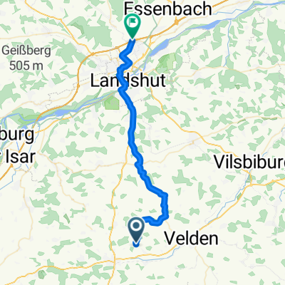
 Rundfahrt Taufkirchen
- Distance
- 249.3 km
- Ascent
- 219 m
- Descent
- 222 m
- Location
- Aham, Bavaria, Germany
 B388, Taufkirchen (Vils) nach Schützenstraße 16B, Vilsbiburg
- Distance
- 22.1 km
- Ascent
- 138 m
- Descent
- 153 m
- Location
- Aham, Bavaria, Germany
 Aham - Ergolding
- Distance
- 33.5 km
- Ascent
- 387 m
- Descent
- 342 m
- Location
- Aham, Bavaria, Germany
 gemütlich
- Distance
- 49.6 km
- Ascent
- 369 m
- Descent
- 369 m
- Location
- Aham, Bavaria, Germany
 2013 Moosen - Holzham(Vilstal RW- Bockerlbahn RW)
- Distance
- 72.3 km
- Ascent
- 184 m
- Descent
- 177 m
- Location
- Aham, Bavaria, Germany
Open it in the app