

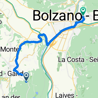
Bozen_St.Michael-Runde_16KM-310HM
A cycling route starting in San Michele, Trentino-Alto Adige, Italy.
Overview
About this route
- -:--
- Duration
- 15.1 km
- Distance
- 337 m
- Ascent
- 338 m
- Descent
- ---
- Avg. speed
- ---
- Max. altitude

Route quality
Waytypes & surfaces along the route
Waytypes
Path
3.9 km
(26 %)
Quiet road
3.6 km
(24 %)
Surfaces
Paved
5.3 km
(35 %)
Unpaved
2.4 km
(16 %)
Asphalt
5.3 km
(35 %)
Gravel
1.5 km
(10 %)
Continue with Bikemap
Use, edit, or download this cycling route
You would like to ride Bozen_St.Michael-Runde_16KM-310HM or customize it for your own trip? Here is what you can do with this Bikemap route:
Free features
- Save this route as favorite or in collections
- Copy & plan your own version of this route
- Sync your route with Garmin or Wahoo
Premium features
Free trial for 3 days, or one-time payment. More about Bikemap Premium.
- Navigate this route on iOS & Android
- Export a GPX / KML file of this route
- Create your custom printout (try it for free)
- Download this route for offline navigation
Discover more Premium features.
Get Bikemap PremiumFrom our community
Other popular routes starting in San Michele
 mendola-palade
- Distance
- 86.3 km
- Ascent
- 1,702 m
- Descent
- 1,702 m
- Location
- San Michele, Trentino-Alto Adige, Italy
 Eppaner Höhenweg
- Distance
- 49.4 km
- Ascent
- 1,185 m
- Descent
- 1,185 m
- Location
- San Michele, Trentino-Alto Adige, Italy
 Dorf tirol
- Distance
- 36.4 km
- Ascent
- 170 m
- Descent
- 356 m
- Location
- San Michele, Trentino-Alto Adige, Italy
 Tour Strada del Vino e Bolzano
- Distance
- 50.1 km
- Ascent
- 363 m
- Descent
- 363 m
- Location
- San Michele, Trentino-Alto Adige, Italy
 Gand-Mendelpass
- Distance
- 13.1 km
- Ascent
- 1,116 m
- Descent
- 265 m
- Location
- San Michele, Trentino-Alto Adige, Italy
 St. Michel - Trient_14_11_19
- Distance
- 58.9 km
- Ascent
- 57 m
- Descent
- 278 m
- Location
- San Michele, Trentino-Alto Adige, Italy
 Alte vie da Appiano a Termeno
- Distance
- 34.3 km
- Ascent
- 1,462 m
- Descent
- 1,610 m
- Location
- San Michele, Trentino-Alto Adige, Italy
 Kornplatz bozen
- Distance
- 15.1 km
- Ascent
- 122 m
- Descent
- 346 m
- Location
- San Michele, Trentino-Alto Adige, Italy
Open it in the app