

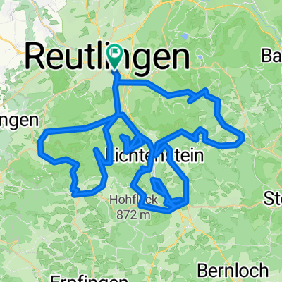
Reutlingen - Südrunde über Stuhlsteige
A cycling route starting in Reutlingen, Baden-Wurttemberg, Germany.
Overview
About this route
The climb over the Stuhlsteige is not only a sporting challenge, but under unfavorable traffic conditions motor vehicles can be quite annoying. Being overtaken by trucks is particularly burdensome, on the one hand usually too tight and on the other because of the diesel plume they leave behind. On weekends, however, it’s an alternative to the usual smaller Alb climbs.
The rest of the route goes over normal to lightly trafficked roads. A highlight for me is the steep descent on the former cog railway between Traifelberg and Honau. But caution! The route is quite narrow and is also frequented by pedestrians and dogs. Always be ready to brake!
- -:--
- Duration
- 63.5 km
- Distance
- 578 m
- Ascent
- 578 m
- Descent
- ---
- Avg. speed
- ---
- Max. altitude

Route quality
Waytypes & surfaces along the route
Waytypes
Track
13.3 km
(21 %)
Road
10.8 km
(17 %)
Surfaces
Paved
54 km
(85 %)
Unpaved
3.2 km
(5 %)
Asphalt
51.4 km
(81 %)
Paved (undefined)
2.5 km
(4 %)
Continue with Bikemap
Use, edit, or download this cycling route
You would like to ride Reutlingen - Südrunde über Stuhlsteige or customize it for your own trip? Here is what you can do with this Bikemap route:
Free features
- Save this route as favorite or in collections
- Copy & plan your own version of this route
- Sync your route with Garmin or Wahoo
Premium features
Free trial for 3 days, or one-time payment. More about Bikemap Premium.
- Navigate this route on iOS & Android
- Export a GPX / KML file of this route
- Create your custom printout (try it for free)
- Download this route for offline navigation
Discover more Premium features.
Get Bikemap PremiumFrom our community
Other popular routes starting in Reutlingen
 Reutlinger Alb - Rauf und runter
- Distance
- 84.1 km
- Ascent
- 2,082 m
- Descent
- 1,861 m
- Location
- Reutlingen, Baden-Wurttemberg, Germany
 Reutlingen-Nebelhöhle
- Distance
- 29.1 km
- Ascent
- 534 m
- Descent
- 534 m
- Location
- Reutlingen, Baden-Wurttemberg, Germany
 Eninger Weide
- Distance
- 15.8 km
- Ascent
- 414 m
- Descent
- 26 m
- Location
- Reutlingen, Baden-Wurttemberg, Germany
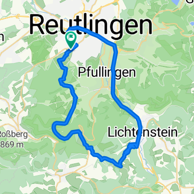
 Reutlingen - Pfullinger Berg - Genkingen
- Distance
- 16.5 km
- Ascent
- 541 m
- Descent
- 142 m
- Location
- Reutlingen, Baden-Wurttemberg, Germany
 RT-Metzingen-Neuffen-Urach-Eningen-RT
- Distance
- 63.8 km
- Ascent
- 1,378 m
- Descent
- 1,216 m
- Location
- Reutlingen, Baden-Wurttemberg, Germany
 Reutlingen Nürtingen Wendlingen 32km 110hm
- Distance
- 32.4 km
- Ascent
- 90 m
- Descent
- 217 m
- Location
- Reutlingen, Baden-Wurttemberg, Germany
 Rund um betzingenoerdelerstraße 53, Reutlingen nach Goerdelerstraße 53, Reutlingen
- Distance
- 41 km
- Ascent
- 573 m
- Descent
- 575 m
- Location
- Reutlingen, Baden-Wurttemberg, Germany
 Albtour
- Distance
- 107.2 km
- Ascent
- 947 m
- Descent
- 950 m
- Location
- Reutlingen, Baden-Wurttemberg, Germany
Open it in the app