

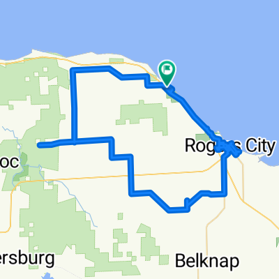
Rogers City to Oscoda via Hubbard Lake
A cycling route starting in Rogers City, Michigan, United States of America.
Overview
About this route
- -:--
- Duration
- 175.7 km
- Distance
- 378 m
- Ascent
- 372 m
- Descent
- ---
- Avg. speed
- ---
- Max. altitude
Route highlights
Points of interest along the route
Point of interest after 121.9 km
The Hardwoods owned by the Butler Family
Continue with Bikemap
Use, edit, or download this cycling route
You would like to ride Rogers City to Oscoda via Hubbard Lake or customize it for your own trip? Here is what you can do with this Bikemap route:
Free features
- Save this route as favorite or in collections
- Copy & plan your own version of this route
- Split it into stages to create a multi-day tour
- Sync your route with Garmin or Wahoo
Premium features
Free trial for 3 days, or one-time payment. More about Bikemap Premium.
- Navigate this route on iOS & Android
- Export a GPX / KML file of this route
- Create your custom printout (try it for free)
- Download this route for offline navigation
Discover more Premium features.
Get Bikemap PremiumFrom our community
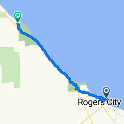
Other popular routes starting in Rogers City
 Rogers City to Hoeft State Park, Rogers City
- Distance
- 63.2 km
- Ascent
- 375 m
- Descent
- 378 m
- Location
- Rogers City, Michigan, United States of America
 7/16 part 2
- Distance
- 60 km
- Ascent
- 98 m
- Descent
- 94 m
- Location
- Rogers City, Michigan, United States of America
 Rogers City to Oscoda via Hubbard Lake
- Distance
- 175.7 km
- Ascent
- 378 m
- Descent
- 372 m
- Location
- Rogers City, Michigan, United States of America
 7/16 part one
- Distance
- 5.3 km
- Ascent
- 24 m
- Descent
- 35 m
- Location
- Rogers City, Michigan, United States of America
 Huron
Huron- Distance
- 15.3 km
- Ascent
- 399 m
- Descent
- 423 m
- Location
- Rogers City, Michigan, United States of America
- Hoeft State Park, Rogers City to Rogers City
- Distance
- 5.1 km
- Ascent
- 18 m
- Descent
- 18 m
- Location
- Rogers City, Michigan, United States of America
 sunrise trail
- Distance
- 9.7 km
- Ascent
- 344 m
- Descent
- 340 m
- Location
- Rogers City, Michigan, United States of America
 45.425° N -83.819° W to 45.486° N -83.913° W
- Distance
- 10.7 km
- Ascent
- 39 m
- Descent
- 42 m
- Location
- Rogers City, Michigan, United States of America
Open it in the app