
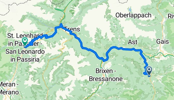
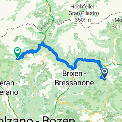
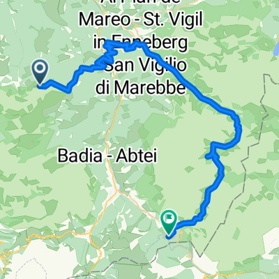
RoDa2019.5
A cycling route starting in San Martino in Badia, Trentino-Alto Adige, Italy.
Overview
About this route
- -:--
- Duration
- 91.2 km
- Distance
- 1,618 m
- Ascent
- 2,197 m
- Descent
- ---
- Avg. speed
- ---
- Max. altitude

Route quality
Waytypes & surfaces along the route
Waytypes
Quiet road
22.8 km
(25 %)
Track
20.1 km
(22 %)
Surfaces
Paved
60.2 km
(66 %)
Unpaved
10.9 km
(12 %)
Asphalt
58.4 km
(64 %)
Gravel
8.2 km
(9 %)
Continue with Bikemap
Use, edit, or download this cycling route
You would like to ride RoDa2019.5 or customize it for your own trip? Here is what you can do with this Bikemap route:
Free features
- Save this route as favorite or in collections
- Copy & plan your own version of this route
- Split it into stages to create a multi-day tour
- Sync your route with Garmin or Wahoo
Premium features
Free trial for 3 days, or one-time payment. More about Bikemap Premium.
- Navigate this route on iOS & Android
- Export a GPX / KML file of this route
- Create your custom printout (try it for free)
- Download this route for offline navigation
Discover more Premium features.
Get Bikemap PremiumFrom our community
Other popular routes starting in San Martino in Badia
 RoDa2019.5
- Distance
- 91.2 km
- Ascent
- 1,618 m
- Descent
- 2,197 m
- Location
- San Martino in Badia, Trentino-Alto Adige, Italy
 Rit tour
- Distance
- 26.4 km
- Ascent
- 1,713 m
- Descent
- 1,727 m
- Location
- San Martino in Badia, Trentino-Alto Adige, Italy
 PlattnerwegJenny
- Distance
- 10 km
- Ascent
- 416 m
- Descent
- 428 m
- Location
- San Martino in Badia, Trentino-Alto Adige, Italy
 St. Martin in Thurn - Corvara
- Distance
- 51.9 km
- Ascent
- 1,661 m
- Descent
- 2,066 m
- Location
- San Martino in Badia, Trentino-Alto Adige, Italy
 WÜrzjoch-Turnaretscher Hütte
- Distance
- 13.2 km
- Ascent
- 727 m
- Descent
- 726 m
- Location
- San Martino in Badia, Trentino-Alto Adige, Italy
 SSTT_2014_najezd
- Distance
- 74.4 km
- Ascent
- 1,727 m
- Descent
- 1,931 m
- Location
- San Martino in Badia, Trentino-Alto Adige, Italy
 Giro Sass de Putia
- Distance
- 12.8 km
- Ascent
- 601 m
- Descent
- 601 m
- Location
- San Martino in Badia, Trentino-Alto Adige, Italy
 Passo delle erbe
- Distance
- 93 km
- Ascent
- 2,696 m
- Descent
- 2,694 m
- Location
- San Martino in Badia, Trentino-Alto Adige, Italy
Open it in the app