

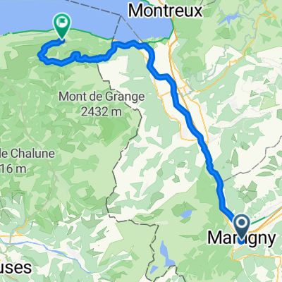
2010.09.03. Martigny - Montreux
A cycling route starting in Martigny-Ville, Valais, Switzerland.
Overview
About this route
September 3rd 2010 I am very near to Montreux. Last night, before the Memorial Day starts, I spend in Martigny. Lovely town with the most pleasant campsite I've ever been. Today I didn't wake up too early:-). Then I visited some beauty towns in Rhone valley (Brig, Sierre, Sion). This is my last post. Thank you for reading this. I hope to see lots of you at FREDDIE in Montreux. Tibor PS: thanks for the big support for Rita, Norbert, Peter, Sándor and Bandus. September 3rd 2010 MONTREUXMUSIC ANNOUNCEMENT: As forseen, TIBOR arrived Saturday at 8.25pm in Montreux. He was welcomed by Peter Freestone, Rita and Norbert. A warm reception was organized for him by Freddie’s statue. After food and beverages he was guided to the Montreux Palace in one of Freddie Mercury’s suite (yes !!) where he could get some rest.
- -:--
- Duration
- 72.4 km
- Distance
- 135 m
- Ascent
- 227 m
- Descent
- ---
- Avg. speed
- ---
- Max. altitude

Continue with Bikemap
Use, edit, or download this cycling route
You would like to ride 2010.09.03. Martigny - Montreux or customize it for your own trip? Here is what you can do with this Bikemap route:
Free features
- Save this route as favorite or in collections
- Copy & plan your own version of this route
- Sync your route with Garmin or Wahoo
Premium features
Free trial for 3 days, or one-time payment. More about Bikemap Premium.
- Navigate this route on iOS & Android
- Export a GPX / KML file of this route
- Create your custom printout (try it for free)
- Download this route for offline navigation
Discover more Premium features.
Get Bikemap PremiumFrom our community
Other popular routes starting in Martigny-Ville
 Martigny-Thollon
- Distance
- 69.9 km
- Ascent
- 1,891 m
- Descent
- 1,444 m
- Location
- Martigny-Ville, Valais, Switzerland
 Colonel
- Distance
- 214.5 km
- Ascent
- 3,599 m
- Descent
- 3,601 m
- Location
- Martigny-Ville, Valais, Switzerland
 1. Etappe: Martigny - Rund um den Mont Blanc nach Les Saisies
- Distance
- 100 km
- Ascent
- 2,702 m
- Descent
- 1,515 m
- Location
- Martigny-Ville, Valais, Switzerland
![[Martigny_000] Col de la Croix de Cœur.](https://media.bikemap.net/routes/7803337/staticmaps/in_cdd017ee-75fd-46e2-a0ec-c59e19bcda56_400x400_bikemap-2021-3D-static.png) [Martigny_000] Col de la Croix de Cœur.
[Martigny_000] Col de la Croix de Cœur.- Distance
- 69.2 km
- Ascent
- 1,694 m
- Descent
- 1,695 m
- Location
- Martigny-Ville, Valais, Switzerland
 VR04 Martigny-St Gingolph.kml - VR04 Martigny-St Gingolph.kml_VR04 Martigny-St Gingolph
- Distance
- 60.4 km
- Ascent
- 408 m
- Descent
- 484 m
- Location
- Martigny-Ville, Valais, Switzerland
 Forclaz backroad - Champex Lac - Col des Planches / Col du Lein
- Distance
- 102 km
- Ascent
- 3,119 m
- Descent
- 3,118 m
- Location
- Martigny-Ville, Valais, Switzerland
 Martigny nach Oberwald
- Distance
- 138.3 km
- Ascent
- 2,322 m
- Descent
- 1,411 m
- Location
- Martigny-Ville, Valais, Switzerland
 Alpencross 2007/1 - Martigny/CH bis Aosta/I
- Distance
- 89.2 km
- Ascent
- 2,705 m
- Descent
- 2,584 m
- Location
- Martigny-Ville, Valais, Switzerland
Open it in the app