Dunoon to Lochgoilhead
A cycling route starting in Dunoon, Scotland, United Kingdom.
Overview
About this route
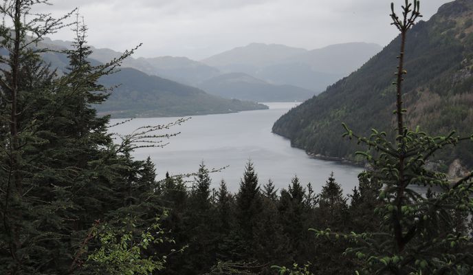
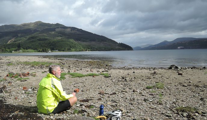
Day 4 exploring the Clyde, this route uses forestry road and a single track to connect up Ardentinny with Lochgoilhead without going all the way to Strachur and Loch Fyne on busy roads. Its clearly a "thing" we met others doing the same in the opposite direction as well as plenty on Strava. From Dunoon we took a diversion to Pucks Glen for a walk before riding along the road to Ardentinny. There's qutie a bit of traffic on the A815 so this short section was not all that pleasant. However the A880 gets increasingly quiet past Strone and it was a lovely easy ride to Ardentinny. There we took a steep forestry road up the hill, down to shore level again then back up. We missed the turnoff to the single track section and climber further than necessary but were rewarded by a great view. On loaded touring bikes, we took the single track carefully with a bit of pushing on steep sections and hrough fallen trees. However, its a fun little ride and a great link to Lochgoilhead.
- -:--
- Duration
- 39.6 km
- Distance
- 505 m
- Ascent
- 507 m
- Descent
- ---
- Avg. speed
- 162 m
- Max. altitude
Route photos
Route quality
Waytypes & surfaces along the route
Waytypes
Road
13.9 km
(35 %)
Track
10.7 km
(27 %)
Surfaces
Paved
1.6 km
(4 %)
Unpaved
9.1 km
(23 %)
Gravel
8.7 km
(22 %)
Asphalt
1.6 km
(4 %)
Continue with Bikemap
Use, edit, or download this cycling route
You would like to ride Dunoon to Lochgoilhead or customize it for your own trip? Here is what you can do with this Bikemap route:
Free features
- Save this route as favorite or in collections
- Copy & plan your own version of this route
- Sync your route with Garmin or Wahoo
Premium features
Free trial for 3 days, or one-time payment. More about Bikemap Premium.
- Navigate this route on iOS & Android
- Export a GPX / KML file of this route
- Create your custom printout (try it for free)
- Download this route for offline navigation
Discover more Premium features.
Get Bikemap PremiumFrom our community
Other popular routes starting in Dunoon
 Dunoon Tighnbruich Cycle
- Distance
- 117.3 km
- Ascent
- 678 m
- Descent
- 678 m
- Location
- Dunoon, Scotland, United Kingdom
 Steady ride in United Kingdom
- Distance
- 103 km
- Ascent
- 2,298 m
- Descent
- 2,240 m
- Location
- Dunoon, Scotland, United Kingdom
 RUTA B: Dunoon - Fort William
- Distance
- 170.6 km
- Ascent
- 2,048 m
- Descent
- 2,054 m
- Location
- Dunoon, Scotland, United Kingdom
 Dunoon to Crear
- Distance
- 80.5 km
- Ascent
- 736 m
- Descent
- 677 m
- Location
- Dunoon, Scotland, United Kingdom
 RUTA A: Dunoon - Fort William
- Distance
- 194.5 km
- Ascent
- 1,957 m
- Descent
- 1,961 m
- Location
- Dunoon, Scotland, United Kingdom
 Dunoon to Portavadie
- Distance
- 47.6 km
- Ascent
- 607 m
- Descent
- 628 m
- Location
- Dunoon, Scotland, United Kingdom
 Dunoon to Crear
- Distance
- 80.5 km
- Ascent
- 736 m
- Descent
- 677 m
- Location
- Dunoon, Scotland, United Kingdom
 GBBR_Glen Finart & Loch Fyne
- Distance
- 119.5 km
- Ascent
- 920 m
- Descent
- 920 m
- Location
- Dunoon, Scotland, United Kingdom
Open it in the app


