

Großglockner Runde, 2. Tag, 2. Etappe
A cycling route starting in Bad Gastein, Salzburg, Austria.
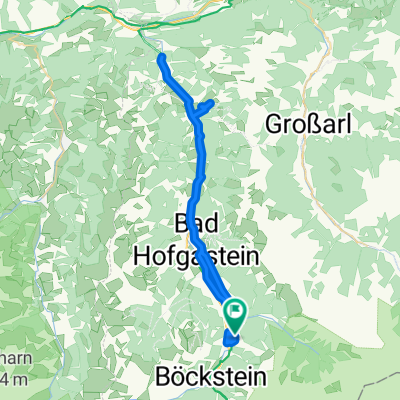
Overview
About this route
Start nach der Zugfahrt am Bhf Böckstein (1170 m) 1. Etappenziel: Bad Gastein (1000 m) [79 km, 5:00, 800hm] 2. Etappenziel: Bad Hofgastein (840 m) [86km, 5:30, 830hm] 3. Etappenziel: Klammtunnel (800 m) [101km, 6:00, 860hm] Ziel: Quartier in Taxenbach (780 m) [112km, 6:30, 1000hm; ca 16,6 km/h]
- -:--
- Duration
- 38.3 km
- Distance
- 566 m
- Ascent
- 968 m
- Descent
- ---
- Avg. speed
- ---
- Max. altitude

Continue with Bikemap
Use, edit, or download this cycling route
You would like to ride Großglockner Runde, 2. Tag, 2. Etappe or customize it for your own trip? Here is what you can do with this Bikemap route:
Free features
- Save this route as favorite or in collections
- Copy & plan your own version of this route
- Sync your route with Garmin or Wahoo
Premium features
Free trial for 3 days, or one-time payment. More about Bikemap Premium.
- Navigate this route on iOS & Android
- Export a GPX / KML file of this route
- Create your custom printout (try it for free)
- Download this route for offline navigation
Discover more Premium features.
Get Bikemap PremiumFrom our community
Other popular routes starting in Bad Gastein
 03 Bad Gastein - Spittal an. d. Drau
- Distance
- 63 km
- Ascent
- 922 m
- Descent
- 1,334 m
- Location
- Bad Gastein, Salzburg, Austria
 Badgastein - Dorfgastein
- Distance
- 51.7 km
- Ascent
- 518 m
- Descent
- 518 m
- Location
- Bad Gastein, Salzburg, Austria
 Fundner Heimalm
- Distance
- 13.4 km
- Ascent
- 556 m
- Descent
- 186 m
- Location
- Bad Gastein, Salzburg, Austria
 Stubnerkogel
- Distance
- 17.8 km
- Ascent
- 1,288 m
- Descent
- 138 m
- Location
- Bad Gastein, Salzburg, Austria
 Karl-Heinrich-Waggerl-Straße 12, Bad Gastein to Kaiser-Franz-Josef-Straße 41, Bad Gastein
- Distance
- 23 km
- Ascent
- 1,149 m
- Descent
- 1,148 m
- Location
- Bad Gastein, Salzburg, Austria
 Bad Gastein - Runde
- Distance
- 54.8 km
- Ascent
- 774 m
- Descent
- 773 m
- Location
- Bad Gastein, Salzburg, Austria
 Bad Gastein 2024
- Distance
- 7.8 km
- Ascent
- 201 m
- Descent
- 199 m
- Location
- Bad Gastein, Salzburg, Austria
 Ei Rastötzen
- Distance
- 16.5 km
- Ascent
- 658 m
- Descent
- 668 m
- Location
- Bad Gastein, Salzburg, Austria
Open it in the app