

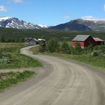
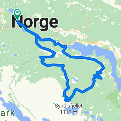
Overview
About this route
- -:--
- Duration
- 22.4 km
- Distance
- 296 m
- Ascent
- 314 m
- Descent
- ---
- Avg. speed
- ---
- Max. altitude

Part of
Golsfjellet og Valdres
4 stages
Route quality
Waytypes & surfaces along the route
Waytypes
Quiet road
19.9 km
(89 %)
Path
1.1 km
(5 %)
Surfaces
Unpaved
21.3 km
(95 %)
Gravel
19.9 km
(89 %)
Ground
1.3 km
(6 %)
Undefined
1.1 km
(5 %)
Continue with Bikemap
Use, edit, or download this cycling route
You would like to ride Syndin - Vaset or customize it for your own trip? Here is what you can do with this Bikemap route:
Free features
- Save this route as favorite or in collections
- Copy & plan your own version of this route
- Sync your route with Garmin or Wahoo
Premium features
Free trial for 3 days, or one-time payment. More about Bikemap Premium.
- Navigate this route on iOS & Android
- Export a GPX / KML file of this route
- Create your custom printout (try it for free)
- Download this route for offline navigation
Discover more Premium features.
Get Bikemap PremiumFrom our community
Other popular routes starting in Vang
 Syndingsstøga - Gol
- Distance
- 71.2 km
- Ascent
- 909 m
- Descent
- 1,654 m
- Location
- Vang, Oppland, Norway
 Helinrunden XL
- Distance
- 61.5 km
- Ascent
- 1,093 m
- Descent
- 1,093 m
- Location
- Vang, Oppland, Norway
 Lomen-Hensåsen
- Distance
- 33 km
- Ascent
- 529 m
- Descent
- 529 m
- Location
- Vang, Oppland, Norway
 Syndin - Vaset
- Distance
- 22.4 km
- Ascent
- 296 m
- Descent
- 314 m
- Location
- Vang, Oppland, Norway
 Vang - Skakadalen - Smådalen - Helin - Vang
- Distance
- 50.5 km
- Ascent
- 1,221 m
- Descent
- 1,221 m
- Location
- Vang, Oppland, Norway
 Tveit - Fiskeløyse - Tveit
- Distance
- 37.3 km
- Ascent
- 879 m
- Descent
- 878 m
- Location
- Vang, Oppland, Norway
 Vang - Sogndal
- Distance
- 122.7 km
- Ascent
- 2,427 m
- Descent
- 2,884 m
- Location
- Vang, Oppland, Norway
 Syndinstøga - Gol
- Distance
- 77.4 km
- Ascent
- 902 m
- Descent
- 1,680 m
- Location
- Vang, Oppland, Norway
Open it in the app