

Baita Segantini, anello
A cycling route starting in Falcade, Veneto, Italy.
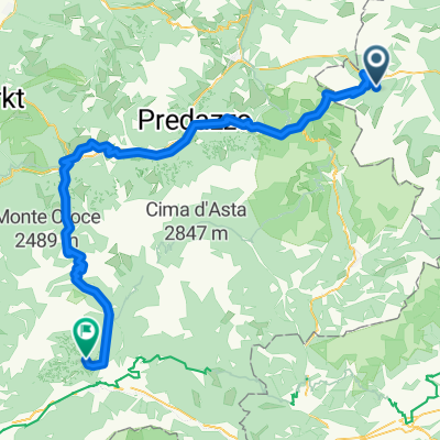
Overview
About this route
- -:--
- Duration
- 11.9 km
- Distance
- 480 m
- Ascent
- 464 m
- Descent
- ---
- Avg. speed
- ---
- Max. altitude

Route quality
Waytypes & surfaces along the route
Waytypes
Track
8.7 km
(73 %)
Path
3.2 km
(27 %)
Surfaces
Unpaved
9.4 km
(79 %)
Gravel
5.9 km
(50 %)
Ground
2.4 km
(20 %)
Continue with Bikemap
Use, edit, or download this cycling route
You would like to ride Baita Segantini, anello or customize it for your own trip? Here is what you can do with this Bikemap route:
Free features
- Save this route as favorite or in collections
- Copy & plan your own version of this route
- Sync your route with Garmin or Wahoo
Premium features
Free trial for 3 days, or one-time payment. More about Bikemap Premium.
- Navigate this route on iOS & Android
- Export a GPX / KML file of this route
- Create your custom printout (try it for free)
- Download this route for offline navigation
Discover more Premium features.
Get Bikemap PremiumFrom our community
Other popular routes starting in Falcade
 Falcade - Alleghe - Passo Staulanza - Longarone - Pieve di Cadore
- Distance
- 92.7 km
- Ascent
- 1,887 m
- Descent
- 2,154 m
- Location
- Falcade, Veneto, Italy
 09072013 falcade - bozen
- Distance
- 159.3 km
- Ascent
- 3,052 m
- Descent
- 4,007 m
- Location
- Falcade, Veneto, Italy
 Italské Alpy 2008 - Trasa 2 (Falcade - Torcegno)
- Distance
- 88.6 km
- Ascent
- 2,558 m
- Descent
- 2,995 m
- Location
- Falcade, Veneto, Italy
 Baita Segantini e Val Venegia
- Distance
- 16 km
- Ascent
- 573 m
- Descent
- 555 m
- Location
- Falcade, Veneto, Italy
 20130711 falcade - falcade
- Distance
- 108.5 km
- Ascent
- 2,366 m
- Descent
- 2,366 m
- Location
- Falcade, Veneto, Italy
 Val Venegia - Baita Segantini Tour 934 - Montagna d'autore: Val Venegia - Baita Segantini
- Distance
- 19.2 km
- Ascent
- 616 m
- Descent
- 616 m
- Location
- Falcade, Veneto, Italy
 4. Etappe über Forcella Franche-Val del Mis
- Distance
- 158.7 km
- Ascent
- 902 m
- Descent
- 2,082 m
- Location
- Falcade, Veneto, Italy
 Rolle, Manghen kör (2. verz): 166 km + 4000 m
- Distance
- 166 km
- Ascent
- 4,060 m
- Descent
- 4,086 m
- Location
- Falcade, Veneto, Italy
Open it in the app