

2023
2023 7 - Argentat à Lacave - 64.3km 240D+
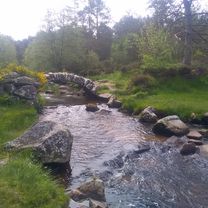
A cycling route starting in Argentat, Nouvelle-Aquitaine, France.
Overview
About this route
Stage at Lacave
Camping La Rivière
05 65 37 02 04
- -:--
- Duration
- 65.5 km
- Distance
- 727 m
- Ascent
- 811 m
- Descent
- ---
- Avg. speed
- 196 m
- Max. altitude

Part of
2023
11 stages
Route quality
Waytypes & surfaces along the route
Waytypes
Road
39.9 km
(61 %)
Quiet road
5.2 km
(8 %)
Surfaces
Paved
13.7 km
(21 %)
Asphalt
13.7 km
(21 %)
Undefined
51.7 km
(79 %)
Continue with Bikemap
Use, edit, or download this cycling route
You would like to ride 2023 7 - Argentat à Lacave - 64.3km 240D+ or customize it for your own trip? Here is what you can do with this Bikemap route:
Free features
- Save this route as favorite or in collections
- Copy & plan your own version of this route
- Sync your route with Garmin or Wahoo
Premium features
Free trial for 3 days, or one-time payment. More about Bikemap Premium.
- Navigate this route on iOS & Android
- Export a GPX / KML file of this route
- Create your custom printout (try it for free)
- Download this route for offline navigation
Discover more Premium features.
Get Bikemap PremiumFrom our community
Other popular routes starting in Argentat
 Argentat Brivezac Bassignac La chapelle Goulles Sexcles Argentat
- Distance
- 58.2 km
- Ascent
- 632 m
- Descent
- 624 m
- Location
- Argentat, Nouvelle-Aquitaine, France
 Argentat-les 4 routes-Moulin Abadiol-Argentat
- Distance
- 59.8 km
- Ascent
- 570 m
- Descent
- 570 m
- Location
- Argentat, Nouvelle-Aquitaine, France
 2023 7 - Argentat à Lacave - 64.3km 240D+
- Distance
- 65.5 km
- Ascent
- 727 m
- Descent
- 811 m
- Location
- Argentat, Nouvelle-Aquitaine, France
 Dordogne Lot 2013
- Distance
- 549.2 km
- Ascent
- 1,128 m
- Descent
- 1,130 m
- Location
- Argentat, Nouvelle-Aquitaine, France
 Argentat pont du Chambon
- Distance
- 98.9 km
- Ascent
- 1,047 m
- Descent
- 1,047 m
- Location
- Argentat, Nouvelle-Aquitaine, France
 Argentat Ally StMartin Ste Eulalie Pléaux argentat
- Distance
- 102.1 km
- Ascent
- 930 m
- Descent
- 930 m
- Location
- Argentat, Nouvelle-Aquitaine, France
 FDN Forgès CP3
- Distance
- 135.5 km
- Ascent
- 1,625 m
- Descent
- 1,699 m
- Location
- Argentat, Nouvelle-Aquitaine, France
 Rivière-Servières-Tours de Merle-La Chapelle-
- Distance
- 74.7 km
- Ascent
- 1,104 m
- Descent
- 1,105 m
- Location
- Argentat, Nouvelle-Aquitaine, France
Open it in the app