

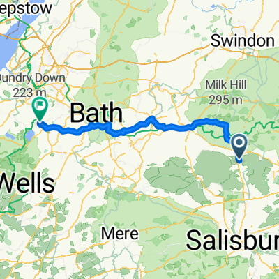
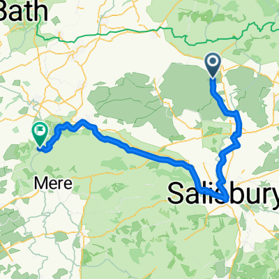
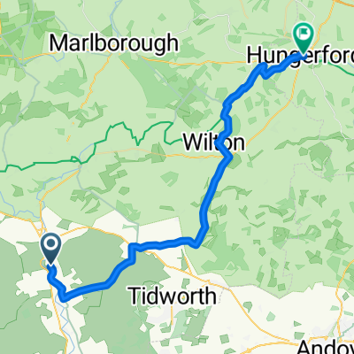
Slow ride in Swindon
A cycling route starting in Rushall, England, United Kingdom.
Overview
About this route
- 4 h 14 min
- Duration
- 53.7 km
- Distance
- 397 m
- Ascent
- 414 m
- Descent
- 12.7 km/h
- Avg. speed
- ---
- Max. altitude

Route photos


Route quality
Waytypes & surfaces along the route
Waytypes
Busy road
29 km
(54 %)
Road
13.9 km
(26 %)
Surfaces
Paved
23.8 km
(44 %)
Unpaved
0.4 km
(<1 %)
Asphalt
23.1 km
(43 %)
Paved (undefined)
0.6 km
(1 %)
Continue with Bikemap
Use, edit, or download this cycling route
You would like to ride Slow ride in Swindon or customize it for your own trip? Here is what you can do with this Bikemap route:
Free features
- Save this route as favorite or in collections
- Copy & plan your own version of this route
- Sync your route with Garmin or Wahoo
Premium features
Free trial for 3 days, or one-time payment. More about Bikemap Premium.
- Navigate this route on iOS & Android
- Export a GPX / KML file of this route
- Create your custom printout (try it for free)
- Download this route for offline navigation
Discover more Premium features.
Get Bikemap PremiumFrom our community
Other popular routes starting in Rushall
 123 miles to Wales coast
- Distance
- 208.3 km
- Ascent
- 552 m
- Descent
- 551 m
- Location
- Rushall, England, United Kingdom
 Slow ride in Swindon
- Distance
- 53.7 km
- Ascent
- 397 m
- Descent
- 414 m
- Location
- Rushall, England, United Kingdom
 Birthday route - Stanton Drew
- Distance
- 74.9 km
- Ascent
- 342 m
- Descent
- 390 m
- Location
- Rushall, England, United Kingdom
 Rushall - Kilmington
- Distance
- 81.2 km
- Ascent
- 901 m
- Descent
- 821 m
- Location
- Rushall, England, United Kingdom
 128 miles
- Distance
- 201.7 km
- Ascent
- 665 m
- Descent
- 663 m
- Location
- Rushall, England, United Kingdom
 51.294° N -1.808° W to 51.373° N -1.835° W
- Distance
- 11.1 km
- Ascent
- 138 m
- Descent
- 13 m
- Location
- Rushall, England, United Kingdom
 Cotswold 6, east Chisenbury-Oxford
- Distance
- 90.6 km
- Ascent
- 473 m
- Descent
- 491 m
- Location
- Rushall, England, United Kingdom
 East Chisenbury- Hungerford
- Distance
- 37.4 km
- Ascent
- 256 m
- Descent
- 241 m
- Location
- Rushall, England, United Kingdom
Open it in the app