

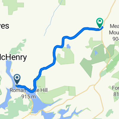
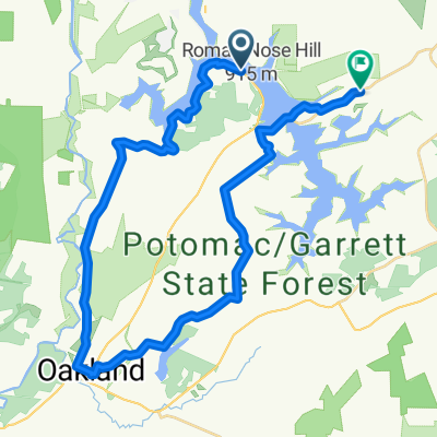
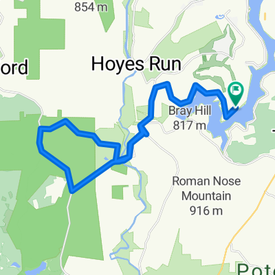
Deep Creek Grand Fondo
A cycling route starting in Oakland, Maryland, United States of America.
Overview
About this route
- -:--
- Duration
- 74.2 km
- Distance
- 799 m
- Ascent
- 802 m
- Descent
- ---
- Avg. speed
- ---
- Avg. speed
Route quality
Waytypes & surfaces along the route
Waytypes
Road
57.6 km
(78 %)
Quiet road
13.5 km
(18 %)
Surfaces
Paved
13.9 km
(19 %)
Asphalt
13.9 km
(19 %)
Undefined
60.4 km
(81 %)
Continue with Bikemap
Use, edit, or download this cycling route
You would like to ride Deep Creek Grand Fondo or customize it for your own trip? Here is what you can do with this Bikemap route:
Free features
- Save this route as favorite or in collections
- Copy & plan your own version of this route
- Sync your route with Garmin or Wahoo
Premium features
Free trial for 3 days, or one-time payment. More about Bikemap Premium.
- Navigate this route on iOS & Android
- Export a GPX / KML file of this route
- Create your custom printout (try it for free)
- Download this route for offline navigation
Discover more Premium features.
Get Bikemap PremiumFrom our community
Other popular routes starting in Oakland
 Wisp Walk 12.5
- Distance
- 22.1 km
- Ascent
- 553 m
- Descent
- 551 m
- Location
- Oakland, Maryland, United States of America
 Deep Creek Grand Fondo
- Distance
- 74.2 km
- Ascent
- 799 m
- Descent
- 802 m
- Location
- Oakland, Maryland, United States of America
 Recovered Route
- Distance
- 20.5 km
- Ascent
- 399 m
- Descent
- 396 m
- Location
- Oakland, Maryland, United States of America
 Deep Creek Lake to Oakland to SIlver Lake
- Distance
- 22.2 km
- Ascent
- 256 m
- Descent
- 225 m
- Location
- Oakland, Maryland, United States of America
 93 Rock Lodge Rd, Mc Henry to 9301–9441 Rock Lodge Rd, Bittinger
- Distance
- 15.4 km
- Ascent
- 232 m
- Descent
- 180 m
- Location
- Oakland, Maryland, United States of America
 Oakland and Cheat River
- Distance
- 170.8 km
- Ascent
- 1,078 m
- Descent
- 1,078 m
- Location
- Oakland, Maryland, United States of America
 26 mile Oakland route
- Distance
- 41.7 km
- Ascent
- 668 m
- Descent
- 626 m
- Location
- Oakland, Maryland, United States of America
 DCL Loop 1
- Distance
- 56.3 km
- Ascent
- 497 m
- Descent
- 492 m
- Location
- Oakland, Maryland, United States of America
Open it in the app