

Reitzengeschwenda - Burgk
A cycling route starting in Drognitz, Thuringia, Germany.
Overview
About this route
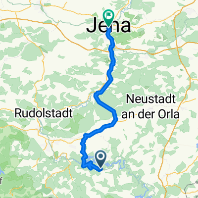
From Reitzengeschwenda, Drognitz, Altenbeuthen to the ferry (Cost: 1 person + bike €1.60). Crossing to Linkenmühle. Following the Saaleradweg signs, we head over Paska to Ziegenrück and further along the Saale to Walsburg. On this stage for me, the most scenic section, as it’s away from the road with no cars. The pub in Walsberg wasn’t great. From Walsberg, take the hiking path to Dorflas. The uphill path is gravel and the bike is partially pushed. From Dorflas towards Grochwitz. Before the village, we followed the old cycle path signs along a field path. Descent to Burgk.
- -:--
- Duration
- 26 km
- Distance
- 413 m
- Ascent
- 497 m
- Descent
- ---
- Avg. speed
- ---
- Max. altitude
Continue with Bikemap
Use, edit, or download this cycling route
You would like to ride Reitzengeschwenda - Burgk or customize it for your own trip? Here is what you can do with this Bikemap route:
Free features
- Save this route as favorite or in collections
- Copy & plan your own version of this route
- Sync your route with Garmin or Wahoo
Premium features
Free trial for 3 days, or one-time payment. More about Bikemap Premium.
- Navigate this route on iOS & Android
- Export a GPX / KML file of this route
- Create your custom printout (try it for free)
- Download this route for offline navigation
Discover more Premium features.
Get Bikemap PremiumFrom our community
Other popular routes starting in Drognitz
 Zeltplatz Hopfenmühle 78, Drognitz nach Saalthal 6, Unterwellenborn
- Distance
- 18.8 km
- Ascent
- 147 m
- Descent
- 174 m
- Location
- Drognitz, Thuringia, Germany
 60er Runde
- Distance
- 60.4 km
- Ascent
- 701 m
- Descent
- 699 m
- Location
- Drognitz, Thuringia, Germany
 Drognitz - Orlamünde
- Distance
- 63.6 km
- Ascent
- 611 m
- Descent
- 992 m
- Location
- Drognitz, Thuringia, Germany
 Rundfahrt
- Distance
- 55.1 km
- Ascent
- 770 m
- Descent
- 770 m
- Location
- Drognitz, Thuringia, Germany
 Saaleradweg
- Distance
- 314.5 km
- Ascent
- 267 m
- Descent
- 721 m
- Location
- Drognitz, Thuringia, Germany
 Reitzengeschwenda - Burgk
- Distance
- 26 km
- Ascent
- 413 m
- Descent
- 497 m
- Location
- Drognitz, Thuringia, Germany
 Feierabend in der Heimat
- Distance
- 9.2 km
- Ascent
- 328 m
- Descent
- 323 m
- Location
- Drognitz, Thuringia, Germany
 Hof bad Berka 2
- Distance
- 59.6 km
- Ascent
- 758 m
- Descent
- 922 m
- Location
- Drognitz, Thuringia, Germany
Open it in the app