

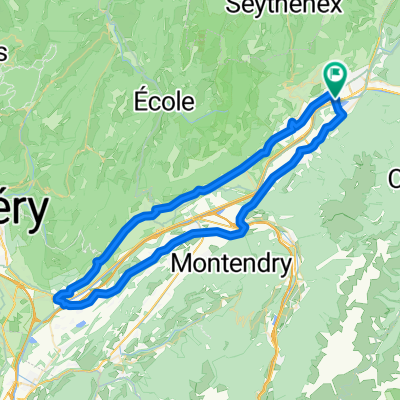
ALBERTVILLE - LA MADELEINE - COL DES CYCLOTURISTES
A cycling route starting in Gilly-sur-Isère, Auvergne-Rhône-Alpes, France.
Overview
About this route
ALBERTVILLE - LA MADELEINE - ALBERTVILLE - COL DES CYCLOTURISTES - ALBERTVILLE
- -:--
- Duration
- 120.6 km
- Distance
- 2,668 m
- Ascent
- 2,668 m
- Descent
- ---
- Avg. speed
- ---
- Max. altitude
Route quality
Waytypes & surfaces along the route
Waytypes
Road
24.1 km
(20 %)
Quiet road
9.6 km
(8 %)
Surfaces
Paved
97.7 km
(81 %)
Asphalt
97.7 km
(81 %)
Undefined
22.9 km
(19 %)
Continue with Bikemap
Use, edit, or download this cycling route
You would like to ride ALBERTVILLE - LA MADELEINE - COL DES CYCLOTURISTES or customize it for your own trip? Here is what you can do with this Bikemap route:
Free features
- Save this route as favorite or in collections
- Copy & plan your own version of this route
- Split it into stages to create a multi-day tour
- Sync your route with Garmin or Wahoo
Premium features
Free trial for 3 days, or one-time payment. More about Bikemap Premium.
- Navigate this route on iOS & Android
- Export a GPX / KML file of this route
- Create your custom printout (try it for free)
- Download this route for offline navigation
Discover more Premium features.
Get Bikemap PremiumFrom our community
Other popular routes starting in Gilly-sur-Isère
 Col du Joly
- Distance
- 91.5 km
- Ascent
- 2,403 m
- Descent
- 2,403 m
- Location
- Gilly-sur-Isère, Auvergne-Rhône-Alpes, France
 ALBERTVILLE - LA MADELEINE - COL DES CYCLOTURISTES
- Distance
- 120.6 km
- Ascent
- 2,668 m
- Descent
- 2,668 m
- Location
- Gilly-sur-Isère, Auvergne-Rhône-Alpes, France
 Sortie de reprise
- Distance
- 43.5 km
- Ascent
- 751 m
- Descent
- 741 m
- Location
- Gilly-sur-Isère, Auvergne-Rhône-Alpes, France
 Reco première partie de l'étape du Dauphiné
- Distance
- 111.5 km
- Ascent
- 3,178 m
- Descent
- 3,169 m
- Location
- Gilly-sur-Isère, Auvergne-Rhône-Alpes, France
 Albertville-Monmelian-Albertville
- Distance
- 68.9 km
- Ascent
- 511 m
- Descent
- 513 m
- Location
- Gilly-sur-Isère, Auvergne-Rhône-Alpes, France
 Francie_2014_1
- Distance
- 71.3 km
- Ascent
- 1,760 m
- Descent
- 1,522 m
- Location
- Gilly-sur-Isère, Auvergne-Rhône-Alpes, France
 loiuytyuyiopoiuy
- Distance
- 185.6 km
- Ascent
- 3,806 m
- Descent
- 3,811 m
- Location
- Gilly-sur-Isère, Auvergne-Rhône-Alpes, France
 Albertville-Col d` Orgeval-Albertville
- Distance
- 78.5 km
- Ascent
- 2,000 m
- Descent
- 1,993 m
- Location
- Gilly-sur-Isère, Auvergne-Rhône-Alpes, France
Open it in the app