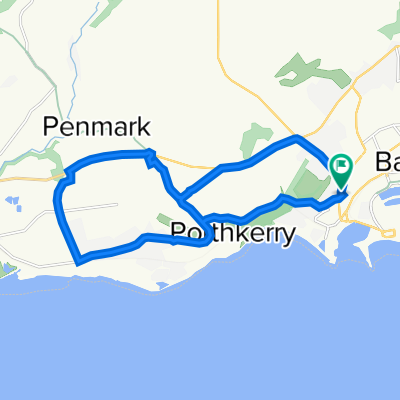
Tour de Wielka Brytania & Irlandia 2018 dzień 3
A cycling route starting in Barry, Wales, United Kingdom.
Overview
About this route
Tre-Hill (A48) – Bonvilston – East Village – Pentre Meyrick – Brocastle – BRIDGEND (A473) – Laleston (A48) – Pyle – PORT TALBOT – Balgan (A483) – SWANSEA (A4067) – Black Pill (A4126-A4118) – Killay (Goetre Fawr Rd) – Dunvant (Garrod Ave) – Gowerton (A484) – LLanelli (B4038) – Pen-y-Mynydd – Trimsaran – (A484) – Upland Arms – Croesyceiliog – Pensarn (A40) – Johnstown – Sarnau – St Clears – Whitland (brzeg rzeki)
- -:--
- Duration
- 134.9 km
- Distance
- 646 m
- Ascent
- 728 m
- Descent
- ---
- Avg. speed
- ---
- Max. altitude
Route quality
Waytypes & surfaces along the route
Waytypes
Cycleway
36.4 km
(27 %)
Quiet road
20.2 km
(15 %)
Surfaces
Paved
98.5 km
(73 %)
Asphalt
95.8 km
(71 %)
Paved (undefined)
2.7 km
(2 %)
Undefined
36.4 km
(27 %)
Route highlights
Points of interest along the route
Accommodation after 134.9 km
nocleg 3
Continue with Bikemap
Use, edit, or download this cycling route
You would like to ride Tour de Wielka Brytania & Irlandia 2018 dzień 3 or customize it for your own trip? Here is what you can do with this Bikemap route:
Free features
- Save this route as favorite or in collections
- Copy & plan your own version of this route
- Split it into stages to create a multi-day tour
- Sync your route with Garmin or Wahoo
Premium features
Free trial for 3 days, or one-time payment. More about Bikemap Premium.
- Navigate this route on iOS & Android
- Export a GPX / KML file of this route
- Create your custom printout (try it for free)
- Download this route for offline navigation
Discover more Premium features.
Get Bikemap PremiumFrom our community
Other popular routes starting in Barry
 Promenade, Barry to Duffryn Lane, Cardiff
- Distance
- 11.1 km
- Ascent
- 3 m
- Descent
- 7 m
- Location
- Barry, Wales, United Kingdom
 Figure of 8 Rhoose & Porthkerry
- Distance
- 17 km
- Ascent
- 139 m
- Descent
- 141 m
- Location
- Barry, Wales, United Kingdom
 Moderate route in Barry
- Distance
- 17.2 km
- Ascent
- 193 m
- Descent
- 214 m
- Location
- Barry, Wales, United Kingdom
 Porthkerry to Southerndown
- Distance
- 29.6 km
- Ascent
- 188 m
- Descent
- 190 m
- Location
- Barry, Wales, United Kingdom
 test home
- Distance
- 16.2 km
- Ascent
- 98 m
- Descent
- 129 m
- Location
- Barry, Wales, United Kingdom
 Canon Street, Barry to Penarth, Penarth
- Distance
- 26.1 km
- Ascent
- 1,810 m
- Descent
- 1,825 m
- Location
- Barry, Wales, United Kingdom
 Lads lads lads
- Distance
- 22.7 km
- Ascent
- 179 m
- Descent
- 179 m
- Location
- Barry, Wales, United Kingdom
 barry-bridgend2
- Distance
- 32.4 km
- Ascent
- 309 m
- Descent
- 293 m
- Location
- Barry, Wales, United Kingdom
Open it in the app


