

über Eußenheim und Gambach nach Wernfeld und zurück
A cycling route starting in Eußenheim, Bavaria, Germany.
Overview
About this route
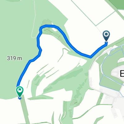
Auf asphaltierten Wegen geht es der ersten Steigung hinauf um auf Schotter- und Waldwegen auch gleich Richtung Eußenheim die erste lange Abfahrt hinunter zu fahren. Durch Eußenheim und den Berg nach Gambach auf erst asphaltierten und anschließend geschotterten Wegen. Nach Gambach geht es zum Humuswerk bei Wernfeld und den Radweg von Wernfeld über Gössenheim zurück auf asphaltierden Wegen.
- -:--
- Duration
- 31.6 km
- Distance
- 361 m
- Ascent
- 361 m
- Descent
- ---
- Avg. speed
- ---
- Max. altitude

Route quality
Waytypes & surfaces along the route
Waytypes
Track
19.8 km
(63 %)
Quiet road
8.9 km
(28 %)
Surfaces
Paved
15.3 km
(48 %)
Unpaved
9.5 km
(30 %)
Asphalt
15 km
(47 %)
Gravel
7.6 km
(24 %)
Continue with Bikemap
Use, edit, or download this cycling route
You would like to ride über Eußenheim und Gambach nach Wernfeld und zurück or customize it for your own trip? Here is what you can do with this Bikemap route:
Free features
- Save this route as favorite or in collections
- Copy & plan your own version of this route
- Sync your route with Garmin or Wahoo
Premium features
Free trial for 3 days, or one-time payment. More about Bikemap Premium.
- Navigate this route on iOS & Android
- Export a GPX / KML file of this route
- Create your custom printout (try it for free)
- Download this route for offline navigation
Discover more Premium features.
Get Bikemap PremiumFrom our community
Other popular routes starting in Eußenheim
 eußenheim-karlstadt-wernfeld-bühler-eußenheim
- Distance
- 37.3 km
- Ascent
- 185 m
- Descent
- 177 m
- Location
- Eußenheim, Bavaria, Germany
 Bachgrund-Runde
- Distance
- 31 km
- Ascent
- 391 m
- Descent
- 390 m
- Location
- Eußenheim, Bavaria, Germany
 Wanderweg Nr. 25a Eußenheim-Aschfeld Bildstockwanderweg I verkürzte Variante
- Distance
- 11 km
- Ascent
- 204 m
- Descent
- 203 m
- Location
- Eußenheim, Bavaria, Germany
 über Eußenheim und Gambach nach Wernfeld und zurück
- Distance
- 31.6 km
- Ascent
- 361 m
- Descent
- 361 m
- Location
- Eußenheim, Bavaria, Germany
 Wanderweg Nr. 03 Eußenheim Dicke Eiche Nach der Fritsch Wanderkarte 88/Wanderkarte Eußenheim 2016
- Distance
- 2 km
- Ascent
- 116 m
- Descent
- 22 m
- Location
- Eußenheim, Bavaria, Germany
 Přejezd Německa 27.7.2016
- Distance
- 138.8 km
- Ascent
- 174 m
- Descent
- 76 m
- Location
- Eußenheim, Bavaria, Germany
 Radtour Eußenheim Halsheim Hundsbach Eußenheim
- Distance
- 28.6 km
- Ascent
- 255 m
- Descent
- 255 m
- Location
- Eußenheim, Bavaria, Germany
 Radtour Eussenheim Wernfeld Karlstadt Eussenheim
- Distance
- 28.5 km
- Ascent
- 165 m
- Descent
- 165 m
- Location
- Eußenheim, Bavaria, Germany
Open it in the app