

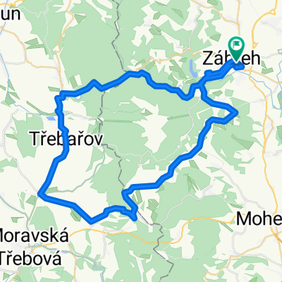
Dolní Bušínov - Mírov a zpátky
A cycling route starting in Zábřeh, Olomoucký kraj, Czechia.
Overview
About this route
- -:--
- Duration
- 15.2 km
- Distance
- 324 m
- Ascent
- 324 m
- Descent
- ---
- Avg. speed
- ---
- Max. altitude

Route quality
Waytypes & surfaces along the route
Waytypes
Road
7.5 km
(49 %)
Track
7.2 km
(47 %)
Surfaces
Paved
4.3 km
(28 %)
Unpaved
3 km
(20 %)
Unpaved (undefined)
2.4 km
(16 %)
Asphalt
2.2 km
(14 %)
Route highlights
Points of interest along the route

Point of interest after 2.1 km

Point of interest after 2.1 km

Point of interest after 2.1 km

Point of interest after 7 km

Point of interest after 7.7 km

Point of interest after 8.4 km

Point of interest after 9.5 km

Point of interest after 9.6 km

Point of interest after 10.2 km

Point of interest after 10.8 km

Point of interest after 11 km

Point of interest after 12 km

Point of interest after 12.9 km

Point of interest after 14.1 km
Continue with Bikemap
Use, edit, or download this cycling route
You would like to ride Dolní Bušínov - Mírov a zpátky or customize it for your own trip? Here is what you can do with this Bikemap route:
Free features
- Save this route as favorite or in collections
- Copy & plan your own version of this route
- Sync your route with Garmin or Wahoo
Premium features
Free trial for 3 days, or one-time payment. More about Bikemap Premium.
- Navigate this route on iOS & Android
- Export a GPX / KML file of this route
- Create your custom printout (try it for free)
- Download this route for offline navigation
Discover more Premium features.
Get Bikemap PremiumFrom our community
Other popular routes starting in Zábřeh
 Ze Zábřehu po zrušené trati dojedete do osady partyzánů
- Distance
- 14.9 km
- Ascent
- 175 m
- Descent
- 137 m
- Location
- Zábřeh, Olomoucký kraj, Czechia
 Trofeo Monte Altvater 2020
- Distance
- 155.6 km
- Ascent
- 3,425 m
- Descent
- 3,144 m
- Location
- Zábřeh, Olomoucký kraj, Czechia
 Zábřeh-Lázek-Zábřeh
- Distance
- 55.2 km
- Ascent
- 505 m
- Descent
- 503 m
- Location
- Zábřeh, Olomoucký kraj, Czechia
 Dolní Bušínov - Mírov a zpátky
- Distance
- 15.2 km
- Ascent
- 324 m
- Descent
- 324 m
- Location
- Zábřeh, Olomoucký kraj, Czechia
 Zábřeh - Petříkov
- Distance
- 45.4 km
- Ascent
- 788 m
- Descent
- 377 m
- Location
- Zábřeh, Olomoucký kraj, Czechia
 Zbr-Brníčko-Hrabišín-Špk-Sudkov-Zbr
- Distance
- 34.7 km
- Ascent
- 130 m
- Descent
- 131 m
- Location
- Zábřeh, Olomoucký kraj, Czechia
 Zbr-Staré Město - Maletín-Zbr
- Distance
- 57 km
- Ascent
- 458 m
- Descent
- 458 m
- Location
- Zábřeh, Olomoucký kraj, Czechia
 Králický Sněžník - Jeseníky
- Distance
- 184.9 km
- Ascent
- 4,258 m
- Descent
- 3,980 m
- Location
- Zábřeh, Olomoucký kraj, Czechia
Open it in the app