

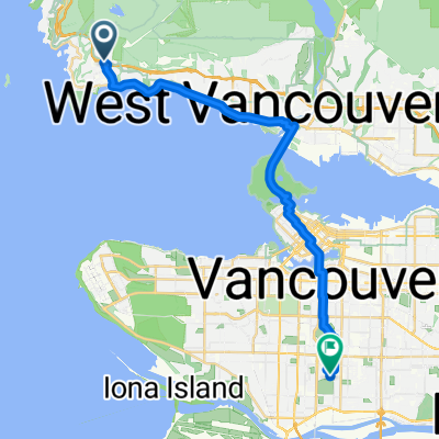
Cypress
A cycling route starting in West Vancouver, British Columbia, Canada.
Overview
About this route
- -:--
- Duration
- 15.7 km
- Distance
- 744 m
- Ascent
- 19 m
- Descent
- ---
- Avg. speed
- ---
- Max. altitude
Route quality
Waytypes & surfaces along the route
Waytypes
Road
15.4 km
(98 %)
Access road
0.3 km
(2 %)
Surfaces
Paved
8.8 km
(56 %)
Asphalt
8.8 km
(56 %)
Undefined
6.9 km
(44 %)
Continue with Bikemap
Use, edit, or download this cycling route
You would like to ride Cypress or customize it for your own trip? Here is what you can do with this Bikemap route:
Free features
- Save this route as favorite or in collections
- Copy & plan your own version of this route
- Sync your route with Garmin or Wahoo
Premium features
Free trial for 3 days, or one-time payment. More about Bikemap Premium.
- Navigate this route on iOS & Android
- Export a GPX / KML file of this route
- Create your custom printout (try it for free)
- Download this route for offline navigation
Discover more Premium features.
Get Bikemap PremiumFrom our community
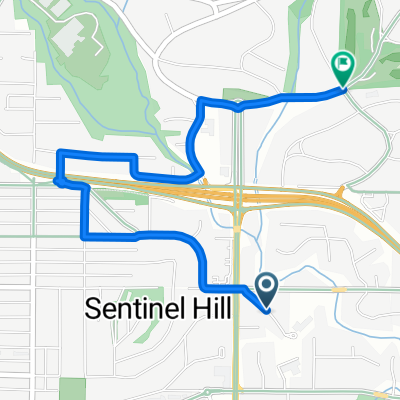
Other popular routes starting in West Vancouver
 807 Main St, Capilano 5 to 4749 Rutland Rd, West Vancouver
- Distance
- 10.4 km
- Ascent
- 254 m
- Descent
- 121 m
- Location
- West Vancouver, British Columbia, Canada
 Summer 2012 Ride Jasper to Vancouver
- Distance
- 861.9 km
- Ascent
- 3,757 m
- Descent
- 2,701 m
- Location
- West Vancouver, British Columbia, Canada
 Seven Bridges
- Distance
- 78.8 km
- Ascent
- 589 m
- Descent
- 589 m
- Location
- West Vancouver, British Columbia, Canada
 4749 Rutland Rd, West Vancouver to 100 W 49th Ave, Vancouver
- Distance
- 24.5 km
- Ascent
- 268 m
- Descent
- 343 m
- Location
- West Vancouver, British Columbia, Canada
 Cypress
- Distance
- 15.7 km
- Ascent
- 744 m
- Descent
- 19 m
- Location
- West Vancouver, British Columbia, Canada
 Route in West Vancouver
- Distance
- 3.3 km
- Ascent
- 117 m
- Descent
- 37 m
- Location
- West Vancouver, British Columbia, Canada
 1495 Bellevue Ave, West Vancouver to 5385 Headland Dr, West Vancouver
- Distance
- 8.9 km
- Ascent
- 252 m
- Descent
- 84 m
- Location
- West Vancouver, British Columbia, Canada
 Cypress Mountain
- Distance
- 15.2 km
- Ascent
- 823 m
- Descent
- 64 m
- Location
- West Vancouver, British Columbia, Canada
Open it in the app