

Zentrale Frankenwaldtour
A cycling route starting in Schlegel, Free State of Thuringia, Germany.
Overview
About this route
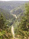
Auf Nebenstraßen und Radwegen durch den zentralen Frankenwald
- -:--
- Duration
- 50.8 km
- Distance
- 535 m
- Ascent
- 535 m
- Descent
- ---
- Avg. speed
- ---
- Max. altitude
Continue with Bikemap
Use, edit, or download this cycling route
You would like to ride Zentrale Frankenwaldtour or customize it for your own trip? Here is what you can do with this Bikemap route:
Free features
- Save this route as favorite or in collections
- Copy & plan your own version of this route
- Sync your route with Garmin or Wahoo
Premium features
Free trial for 3 days, or one-time payment. More about Bikemap Premium.
- Navigate this route on iOS & Android
- Export a GPX / KML file of this route
- Create your custom printout (try it for free)
- Download this route for offline navigation
Discover more Premium features.
Get Bikemap PremiumFrom our community
Other popular routes starting in Schlegel
 Schwarzenbach-Steinbach-Bad Steben
- Distance
- 39.4 km
- Ascent
- 456 m
- Descent
- 456 m
- Location
- Schlegel, Free State of Thuringia, Germany
 Sieglitzberg Lobenstein
- Distance
- 40.6 km
- Ascent
- 458 m
- Descent
- 742 m
- Location
- Schlegel, Free State of Thuringia, Germany
 Zentrale Frankenwaldtour
- Distance
- 50.8 km
- Ascent
- 535 m
- Descent
- 535 m
- Location
- Schlegel, Free State of Thuringia, Germany
 Radwegenetz Bad Steben, Naila, Schwarzenbach W
- Distance
- 39.4 km
- Ascent
- 478 m
- Descent
- 478 m
- Location
- Schlegel, Free State of Thuringia, Germany
 Schlegel-Mödlareuth
- Distance
- 26.5 km
- Ascent
- 557 m
- Descent
- 641 m
- Location
- Schlegel, Free State of Thuringia, Germany
 Auf den Spuren der Flöser
- Distance
- 22.5 km
- Ascent
- 454 m
- Descent
- 450 m
- Location
- Schlegel, Free State of Thuringia, Germany
 EuroVelo 13 - Iron Curtain Trail - part 10
- Distance
- 43.3 km
- Ascent
- 809 m
- Descent
- 733 m
- Location
- Schlegel, Free State of Thuringia, Germany
 Die Langenbacher Runde
- Distance
- 35.9 km
- Ascent
- 596 m
- Descent
- 596 m
- Location
- Schlegel, Free State of Thuringia, Germany
Open it in the app