

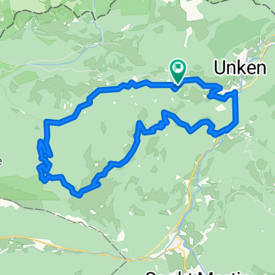
Rundtour ab Schneizlreuth - Achenbergrunde
A cycling route starting in Unken, Salzburg, Austria.
Overview
About this route
- 2 h 10 min
- Duration
- 17.7 km
- Distance
- 831 m
- Ascent
- 894 m
- Descent
- 8.2 km/h
- Avg. speed
- ---
- Max. altitude
Route photos


Route quality
Waytypes & surfaces along the route
Waytypes
Track
12.4 km
(70 %)
Quiet road
2.8 km
(16 %)
Surfaces
Paved
4.4 km
(25 %)
Unpaved
9.7 km
(55 %)
Gravel
8.7 km
(49 %)
Asphalt
3.4 km
(19 %)
Continue with Bikemap
Use, edit, or download this cycling route
You would like to ride Rundtour ab Schneizlreuth - Achenbergrunde or customize it for your own trip? Here is what you can do with this Bikemap route:
Free features
- Save this route as favorite or in collections
- Copy & plan your own version of this route
- Sync your route with Garmin or Wahoo
Premium features
Free trial for 3 days, or one-time payment. More about Bikemap Premium.
- Navigate this route on iOS & Android
- Export a GPX / KML file of this route
- Create your custom printout (try it for free)
- Download this route for offline navigation
Discover more Premium features.
Get Bikemap PremiumFrom our community
Other popular routes starting in Unken
 Sonntagshornrunde
- Distance
- 48.5 km
- Ascent
- 984 m
- Descent
- 985 m
- Location
- Unken, Salzburg, Austria
 Rundtour ab Schneizlreuth - Achenbergrunde
- Distance
- 17.7 km
- Ascent
- 831 m
- Descent
- 894 m
- Location
- Unken, Salzburg, Austria
 Loferer Alm 32 km
- Distance
- 32 km
- Ascent
- 1,085 m
- Descent
- 1,085 m
- Location
- Unken, Salzburg, Austria
 Sonntagshorn Runde
- Distance
- 44.6 km
- Ascent
- 1,383 m
- Descent
- 1,425 m
- Location
- Unken, Salzburg, Austria
 Friedlwirt Heutal Winkelmoser Möserer Loferer Alm Dietrichshorn
- Distance
- 41.8 km
- Ascent
- 1,335 m
- Descent
- 1,380 m
- Location
- Unken, Salzburg, Austria
 LOFERER ALM
- Distance
- 40.5 km
- Ascent
- 1,563 m
- Descent
- 1,563 m
- Location
- Unken, Salzburg, Austria
 ZARM 2023 2. Tag
- Distance
- 69.1 km
- Ascent
- 988 m
- Descent
- 760 m
- Location
- Unken, Salzburg, Austria
 Reiter Steinbergrunde
- Distance
- 52 km
- Ascent
- 897 m
- Descent
- 894 m
- Location
- Unken, Salzburg, Austria
Open it in the app