

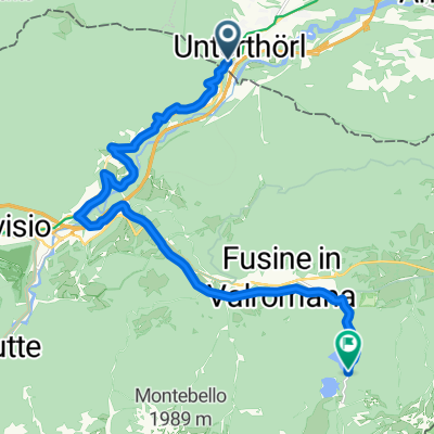
Dreiländereck
A cycling route starting in Hohenthurn, Carinthia, Austria.
Overview
About this route
- -:--
- Duration
- 174.2 km
- Distance
- 2,853 m
- Ascent
- 2,820 m
- Descent
- ---
- Avg. speed
- ---
- Max. altitude
Route quality
Waytypes & surfaces along the route
Waytypes
Quiet road
38.3 km
(22 %)
Cycleway
27.9 km
(16 %)
Surfaces
Paved
121.9 km
(70 %)
Unpaved
5.2 km
(3 %)
Asphalt
111.5 km
(64 %)
Paved (undefined)
10.5 km
(6 %)
Route highlights
Points of interest along the route
Accommodation after 58.7 km
Guest House Mystic River 031407790
Accommodation after 113.4 km
Rosa Dei Venti - BB +39 340 781 1178
Continue with Bikemap
Use, edit, or download this cycling route
You would like to ride Dreiländereck or customize it for your own trip? Here is what you can do with this Bikemap route:
Free features
- Save this route as favorite or in collections
- Copy & plan your own version of this route
- Split it into stages to create a multi-day tour
- Sync your route with Garmin or Wahoo
Premium features
Free trial for 3 days, or one-time payment. More about Bikemap Premium.
- Navigate this route on iOS & Android
- Export a GPX / KML file of this route
- Create your custom printout (try it for free)
- Download this route for offline navigation
Discover more Premium features.
Get Bikemap PremiumFrom our community
Other popular routes starting in Hohenthurn
 Von Arnoldstein bis lago di fusine
- Distance
- 15.5 km
- Ascent
- 691 m
- Descent
- 413 m
- Location
- Hohenthurn, Carinthia, Austria
 Tarvis Bled
- Distance
- 59.8 km
- Ascent
- 831 m
- Descent
- 1,011 m
- Location
- Hohenthurn, Carinthia, Austria
 Bartolosattel
- Distance
- 32.1 km
- Ascent
- 660 m
- Descent
- 657 m
- Location
- Hohenthurn, Carinthia, Austria
 sLOVEnia
- Distance
- 456.7 km
- Ascent
- 8,412 m
- Descent
- 8,414 m
- Location
- Hohenthurn, Carinthia, Austria
 MTB-Berg: Draschitz - Feistritz/Gail - Feistritzbach - Bartolosattel - Tarvisio - Unterthörl - Draschitz
- Distance
- 30.3 km
- Ascent
- 900 m
- Descent
- 901 m
- Location
- Hohenthurn, Carinthia, Austria
 MTB-Trail: ThörlMaglernZoll-Pressendellach-Draschitz-Göriach-Achomitz-AchomitzerAlm-TRAIL-WW508-ArlecchinoTRAIL-Camporosso-Tarvisio-Coccau-ThörlMaglernZoll
- Distance
- 37.4 km
- Ascent
- 1,474 m
- Descent
- 1,470 m
- Location
- Hohenthurn, Carinthia, Austria
 Von Arnoldstein bis Tarvis
- Distance
- 9.9 km
- Ascent
- 390 m
- Descent
- 300 m
- Location
- Hohenthurn, Carinthia, Austria
 soca
soca- Distance
- 99.4 km
- Ascent
- 2,367 m
- Descent
- 2,353 m
- Location
- Hohenthurn, Carinthia, Austria
Open it in the app