

Overview
About this route
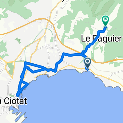
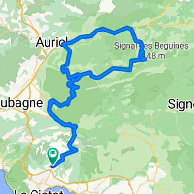
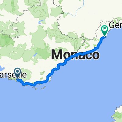
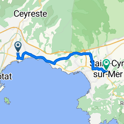
La Ciotat to Hyeres
- -:--
- Duration
- 54.4 km
- Distance
- 350 m
- Ascent
- 357 m
- Descent
- ---
- Avg. speed
- ---
- Max. altitude

Part of
June training
4 stages
Route quality
Waytypes & surfaces along the route
Waytypes
Cycleway
15.8 km
(29 %)
Quiet road
10.9 km
(20 %)
Surfaces
Paved
42.4 km
(78 %)
Asphalt
42.4 km
(78 %)
Undefined
12 km
(22 %)
Continue with Bikemap
Use, edit, or download this cycling route
You would like to ride day 2 or customize it for your own trip? Here is what you can do with this Bikemap route:
Free features
- Save this route as favorite or in collections
- Copy & plan your own version of this route
- Sync your route with Garmin or Wahoo
Premium features
Free trial for 3 days, or one-time payment. More about Bikemap Premium.
- Navigate this route on iOS & Android
- Export a GPX / KML file of this route
- Create your custom printout (try it for free)
- Download this route for offline navigation
Discover more Premium features.
Get Bikemap PremiumFrom our community
Other popular routes starting in Ceyreste
 La Ciotat nach Chemin du Clos de Sainte-Marie, Ceyreste
- Distance
- 13.4 km
- Ascent
- 273 m
- Descent
- 132 m
- Location
- Ceyreste, Provence-Alpes-Côte d'Azur Region, France
 Ceyreste-Saint Zacharie-Nans-Ceyreste
- Distance
- 103.3 km
- Ascent
- 1,722 m
- Descent
- 1,722 m
- Location
- Ceyreste, Provence-Alpes-Côte d'Azur Region, France
 "Le Grand Caunet"
- Distance
- 35 km
- Ascent
- 468 m
- Descent
- 468 m
- Location
- Ceyreste, Provence-Alpes-Côte d'Azur Region, France
 La Ciotat - Le Broussan
- Distance
- 70 km
- Ascent
- 896 m
- Descent
- 896 m
- Location
- Ceyreste, Provence-Alpes-Côte d'Azur Region, France
 Von Ceyreste bis Finale Ligure
- Distance
- 374.6 km
- Ascent
- 7,313 m
- Descent
- 7,373 m
- Location
- Ceyreste, Provence-Alpes-Côte d'Azur Region, France
 Allée des Cinsaults, La Ciotat à Place Docteur Roux, Saint-Cyr-sur-Mer
- Distance
- 9.9 km
- Ascent
- 156 m
- Descent
- 146 m
- Location
- Ceyreste, Provence-Alpes-Côte d'Azur Region, France
 La route des crêtes et des vignobles (La Ciotat)
- Distance
- 74.8 km
- Ascent
- 1,502 m
- Descent
- 1,500 m
- Location
- Ceyreste, Provence-Alpes-Côte d'Azur Region, France
 La Ciotat-Route des Crètes-27km-490hm
- Distance
- 27.1 km
- Ascent
- 486 m
- Descent
- 483 m
- Location
- Ceyreste, Provence-Alpes-Côte d'Azur Region, France
Open it in the app