

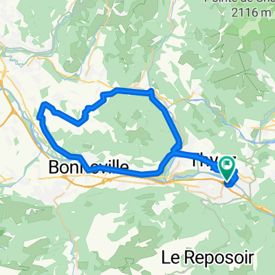
Col de Colombière both side and Col de Romme
A cycling route starting in Scionzier, Auvergne-Rhône-Alpes, France.
Overview
About this route
- -:--
- Duration
- 66.3 km
- Distance
- 2,103 m
- Ascent
- 2,107 m
- Descent
- ---
- Avg. speed
- ---
- Max. altitude

Route quality
Waytypes & surfaces along the route
Waytypes
Road
15.2 km
(23 %)
Quiet road
2 km
(3 %)
Surfaces
Paved
57.7 km
(87 %)
Asphalt
57.7 km
(87 %)
Undefined
8.6 km
(13 %)
Route highlights
Points of interest along the route
Point of interest after 40.7 km
Col de la Colombière
Point of interest after 54.5 km
Col de Romme
Continue with Bikemap
Use, edit, or download this cycling route
You would like to ride Col de Colombière both side and Col de Romme or customize it for your own trip? Here is what you can do with this Bikemap route:
Free features
- Save this route as favorite or in collections
- Copy & plan your own version of this route
- Sync your route with Garmin or Wahoo
Premium features
Free trial for 3 days, or one-time payment. More about Bikemap Premium.
- Navigate this route on iOS & Android
- Export a GPX / KML file of this route
- Create your custom printout (try it for free)
- Download this route for offline navigation
Discover more Premium features.
Get Bikemap PremiumFrom our community
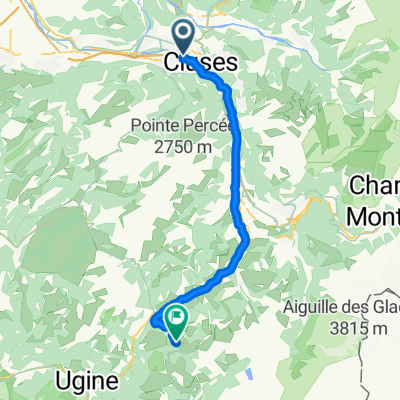
Other popular routes starting in Scionzier
 Cluses J4 Cyclos
- Distance
- 48.9 km
- Ascent
- 459 m
- Descent
- 458 m
- Location
- Scionzier, Auvergne-Rhône-Alpes, France
 Fra - day 2_po dolini
- Distance
- 45.4 km
- Ascent
- 1,151 m
- Descent
- 168 m
- Location
- Scionzier, Auvergne-Rhône-Alpes, France
 Cluses J3 Cyclos
- Distance
- 107.3 km
- Ascent
- 1,191 m
- Descent
- 1,191 m
- Location
- Scionzier, Auvergne-Rhône-Alpes, France
 Cluses J3 Sportifs
- Distance
- 127.2 km
- Ascent
- 2,347 m
- Descent
- 2,347 m
- Location
- Scionzier, Auvergne-Rhône-Alpes, France
 Fra - day 2_3
- Distance
- 65.3 km
- Ascent
- 2,206 m
- Descent
- 1,223 m
- Location
- Scionzier, Auvergne-Rhône-Alpes, France
 Col de Colombière both side and Col de Romme
- Distance
- 66.3 km
- Ascent
- 2,103 m
- Descent
- 2,107 m
- Location
- Scionzier, Auvergne-Rhône-Alpes, France
 MONT SAXONNEX - COLOMBIERE
- Distance
- 67.5 km
- Ascent
- 1,769 m
- Descent
- 1,769 m
- Location
- Scionzier, Auvergne-Rhône-Alpes, France
 Etape 2a - Route grands Alpes
- Distance
- 25.7 km
- Ascent
- 816 m
- Descent
- 709 m
- Location
- Scionzier, Auvergne-Rhône-Alpes, France
Open it in the app