

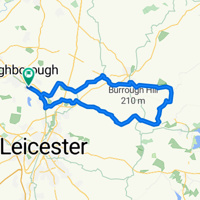
Bradgate Cropstone Rothley
A cycling route starting in Quorndon, England, United Kingdom.
Overview
About this route
- -:--
- Duration
- 28.9 km
- Distance
- 182 m
- Ascent
- 179 m
- Descent
- ---
- Avg. speed
- ---
- Max. altitude
Route quality
Waytypes & surfaces along the route
Waytypes
Road
22.7 km
(79 %)
Access road
3.5 km
(12 %)
Surfaces
Paved
6 km
(21 %)
Asphalt
6 km
(21 %)
Undefined
22.9 km
(79 %)
Continue with Bikemap
Use, edit, or download this cycling route
You would like to ride Bradgate Cropstone Rothley or customize it for your own trip? Here is what you can do with this Bikemap route:
Free features
- Save this route as favorite or in collections
- Copy & plan your own version of this route
- Sync your route with Garmin or Wahoo
Premium features
Free trial for 3 days, or one-time payment. More about Bikemap Premium.
- Navigate this route on iOS & Android
- Export a GPX / KML file of this route
- Create your custom printout (try it for free)
- Download this route for offline navigation
Discover more Premium features.
Get Bikemap PremiumFrom our community
Other popular routes starting in Quorndon
 old woodhouse and back
- Distance
- 4.2 km
- Ascent
- 93 m
- Descent
- 90 m
- Location
- Quorndon, England, United Kingdom
 wood house eaves -> woodthorpe -> quorn -> old woodhouse -> Windmill
- Distance
- 13.6 km
- Ascent
- 143 m
- Descent
- 140 m
- Location
- Quorndon, England, United Kingdom
 Welford
- Distance
- 96 km
- Ascent
- 609 m
- Descent
- 605 m
- Location
- Quorndon, England, United Kingdom
 Bradgate Cropstone Rothley
- Distance
- 28.9 km
- Ascent
- 182 m
- Descent
- 179 m
- Location
- Quorndon, England, United Kingdom
 From Loughborough to Quorn around bradgate and back.
- Distance
- 42.5 km
- Ascent
- 426 m
- Descent
- 417 m
- Location
- Quorndon, England, United Kingdom
 Wood house eaves -> Beacon hill -> Windmill
- Distance
- 7 km
- Ascent
- 206 m
- Descent
- 205 m
- Location
- Quorndon, England, United Kingdom
 Cold overton loop
- Distance
- 77.8 km
- Ascent
- 365 m
- Descent
- 366 m
- Location
- Quorndon, England, United Kingdom
 Woodhouse Eaves to Newbold Verdon Circuit
- Distance
- 51.5 km
- Ascent
- 301 m
- Descent
- 304 m
- Location
- Quorndon, England, United Kingdom
Open it in the app