

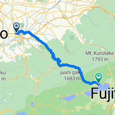
ETAPA 19. Kofu - Lake Motosu/Lake Shoji
A cycling route starting in Kofu, Yamanashi, Japan.
Overview
About this route
- -:--
- Duration
- 57.5 km
- Distance
- 1,073 m
- Ascent
- 444 m
- Descent
- ---
- Avg. speed
- ---
- Max. altitude

Continue with Bikemap
Use, edit, or download this cycling route
You would like to ride ETAPA 19. Kofu - Lake Motosu/Lake Shoji or customize it for your own trip? Here is what you can do with this Bikemap route:
Free features
- Save this route as favorite or in collections
- Copy & plan your own version of this route
- Sync your route with Garmin or Wahoo
Premium features
Free trial for 3 days, or one-time payment. More about Bikemap Premium.
- Navigate this route on iOS & Android
- Export a GPX / KML file of this route
- Create your custom printout (try it for free)
- Download this route for offline navigation
Discover more Premium features.
Get Bikemap PremiumFrom our community
Other popular routes starting in Kofu
 宝2丁目15-14, 甲府市 to 宝1丁目34-12, 甲府市
- Distance
- 128.5 km
- Ascent
- 1,256 m
- Descent
- 1,253 m
- Location
- Kofu, Yamanashi, Japan
 Kofu to Oishi Park, Fujikawaguchiko
- Distance
- 26.6 km
- Ascent
- 1,620 m
- Descent
- 1,040 m
- Location
- Kofu, Yamanashi, Japan
 甲府盆地大回りコース
- Distance
- 48.2 km
- Ascent
- 158 m
- Descent
- 158 m
- Location
- Kofu, Yamanashi, Japan
 Kufo to Yamanakako
- Distance
- 59 km
- Ascent
- 1,263 m
- Descent
- 547 m
- Location
- Kofu, Yamanashi, Japan
 Kofu to home (?)
- Distance
- 154.4 km
- Ascent
- 3,286 m
- Descent
- 3,564 m
- Location
- Kofu, Yamanashi, Japan
 甲府盆地北回りコース
- Distance
- 44.1 km
- Ascent
- 1,255 m
- Descent
- 1,254 m
- Location
- Kofu, Yamanashi, Japan
 ETAPA 19. Kofu - Lake Motosu/Lake Shoji
- Distance
- 57.5 km
- Ascent
- 1,073 m
- Descent
- 444 m
- Location
- Kofu, Yamanashi, Japan
 Aoba-dori Street, Kofu to 1, Takaminecho, Chikusa, Nagoya
- Distance
- 249.3 km
- Ascent
- 4,141 m
- Descent
- 4,345 m
- Location
- Kofu, Yamanashi, Japan
Open it in the app