

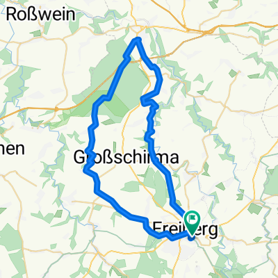
Freiberg durchs Gimmlitztal nach Osek
A cycling route starting in Freiberg, Saxony, Germany.
Overview
About this route
A very scenic route passing the Lichtenberg dam through the Gimmlitz valley to the Gimmlitz spring. From there, it goes downhill to the Mulde and over the border to Moldava, quickly climbing the last mountain here and then in Nove Mesto speedily descending over ski slopes and woodland paths down to the Bohemian Basin and off to Osek.
- -:--
- Duration
- 57.8 km
- Distance
- 734 m
- Ascent
- 799 m
- Descent
- ---
- Avg. speed
- ---
- Max. altitude

Route quality
Waytypes & surfaces along the route
Waytypes
Track
21.4 km
(37 %)
Quiet road
6.9 km
(12 %)
Surfaces
Paved
30 km
(52 %)
Unpaved
16.2 km
(28 %)
Asphalt
29.5 km
(51 %)
Gravel
6.4 km
(11 %)
Route highlights
Points of interest along the route
Point of interest after 16.3 km
Zum singenden Wirt
Point of interest after 36.7 km
Gimmlitzquelle
Continue with Bikemap
Use, edit, or download this cycling route
You would like to ride Freiberg durchs Gimmlitztal nach Osek or customize it for your own trip? Here is what you can do with this Bikemap route:
Free features
- Save this route as favorite or in collections
- Copy & plan your own version of this route
- Sync your route with Garmin or Wahoo
Premium features
Free trial for 3 days, or one-time payment. More about Bikemap Premium.
- Navigate this route on iOS & Android
- Export a GPX / KML file of this route
- Create your custom printout (try it for free)
- Download this route for offline navigation
Discover more Premium features.
Get Bikemap PremiumFrom our community
Other popular routes starting in Freiberg
 Freiberg - Dresden
- Distance
- 50.2 km
- Ascent
- 329 m
- Descent
- 597 m
- Location
- Freiberg, Saxony, Germany
 Optisch optimierte FG-DD Route
- Distance
- 48.4 km
- Ascent
- 337 m
- Descent
- 636 m
- Location
- Freiberg, Saxony, Germany
 Freiberg-Niederschöna-Mulde-Münzbachtal
- Distance
- 29.4 km
- Ascent
- 366 m
- Descent
- 384 m
- Location
- Freiberg, Saxony, Germany
 FG->Blockhausen->FG
- Distance
- 60.3 km
- Ascent
- 0 m
- Descent
- 0 m
- Location
- Freiberg, Saxony, Germany
 Freiberg-Grünhainichen-Großrückerswalde
- Distance
- 46.3 km
- Ascent
- 734 m
- Descent
- 513 m
- Location
- Freiberg, Saxony, Germany
 MTB Trainingsrunde Rund um Freiberg
- Distance
- 26.5 km
- Ascent
- 283 m
- Descent
- 281 m
- Location
- Freiberg, Saxony, Germany
 ZuH-Hilbd-Klingenb-TalspKlingenb-Pretschend-Lichtenb-Weißb-FG 51km
- Distance
- 50.7 km
- Ascent
- 503 m
- Descent
- 503 m
- Location
- Freiberg, Saxony, Germany
 Freiberg-Nossen-Reichenbach-Freiberg
- Distance
- 45.1 km
- Ascent
- 374 m
- Descent
- 371 m
- Location
- Freiberg, Saxony, Germany
Open it in the app