

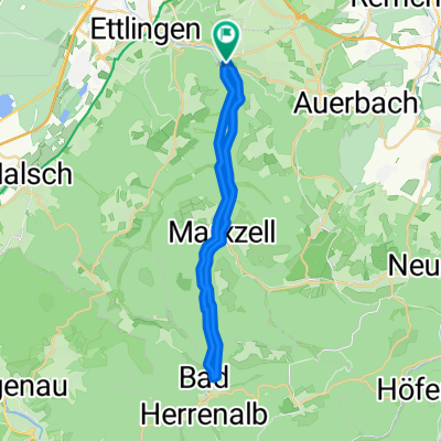
Ettlingen-Teufelsmühle-Ettlingen
A cycling route starting in Ettlingen, Baden-Wurttemberg, Germany.
Overview
About this route
Ab Ettlingen mit leichter Steigung durch das Albtal (Graf-Rhena-Weg) nach Bad Herrenalb.
Schon etwas steiler den Albtalweg rauf an der Plotzsägmühle vorbei. (Am Wochenende etwas überwandert.)
Noch etwas steiler hoch zur Teufelsmühle. (Hier wandert keiner mehr.)
Wieder runter mit 60-70 Sachen...
- -:--
- Duration
- 70.6 km
- Distance
- 973 m
- Ascent
- 973 m
- Descent
- ---
- Avg. speed
- ---
- Max. altitude
Route quality
Waytypes & surfaces along the route
Waytypes
Track
45.3 km
(64 %)
Quiet road
9.2 km
(13 %)
Surfaces
Paved
36.5 km
(52 %)
Unpaved
33.2 km
(47 %)
Asphalt
29.5 km
(42 %)
Gravel
18.5 km
(26 %)
Continue with Bikemap
Use, edit, or download this cycling route
You would like to ride Ettlingen-Teufelsmühle-Ettlingen or customize it for your own trip? Here is what you can do with this Bikemap route:
Free features
- Save this route as favorite or in collections
- Copy & plan your own version of this route
- Sync your route with Garmin or Wahoo
Premium features
Free trial for 3 days, or one-time payment. More about Bikemap Premium.
- Navigate this route on iOS & Android
- Export a GPX / KML file of this route
- Create your custom printout (try it for free)
- Download this route for offline navigation
Discover more Premium features.
Get Bikemap PremiumFrom our community
Other popular routes starting in Ettlingen
 Karlsbad Rundtour
- Distance
- 25.2 km
- Ascent
- 210 m
- Descent
- 283 m
- Location
- Ettlingen, Baden-Wurttemberg, Germany
 Albtal
- Distance
- 28.8 km
- Ascent
- 552 m
- Descent
- 554 m
- Location
- Ettlingen, Baden-Wurttemberg, Germany
 Kleine Moosalbtalrunde
- Distance
- 25.8 km
- Ascent
- 444 m
- Descent
- 451 m
- Location
- Ettlingen, Baden-Wurttemberg, Germany
 Ettlingen-Teufelsmühle-Ettlingen
- Distance
- 70.6 km
- Ascent
- 973 m
- Descent
- 973 m
- Location
- Ettlingen, Baden-Wurttemberg, Germany
 Ettlingen -> Hohloh -> Dobel -> Teufelsmühle -> Ettlingen
- Distance
- 129.1 km
- Ascent
- 2,550 m
- Descent
- 2,238 m
- Location
- Ettlingen, Baden-Wurttemberg, Germany
 Karlsbad-Schwanner Warte-Ellmendingen
- Distance
- 29.8 km
- Ascent
- 406 m
- Descent
- 409 m
- Location
- Ettlingen, Baden-Wurttemberg, Germany
 ka - spessart - burbach - dobel - turmberg
- Distance
- 77.7 km
- Ascent
- 900 m
- Descent
- 900 m
- Location
- Ettlingen, Baden-Wurttemberg, Germany
 Ettlingen-BadHerrenalb
- Distance
- 17.2 km
- Ascent
- 481 m
- Descent
- 254 m
- Location
- Ettlingen, Baden-Wurttemberg, Germany
Open it in the app