

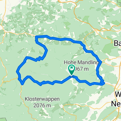
Pernitz_Ramsau_Hals
A cycling route starting in Pernitz, Lower Austria, Austria.
Overview
About this route
Am Sonntag sind sehr viele Motorräder unterwegs - wenn möglich die Runde am Samstag planen.
- -:--
- Duration
- 102.6 km
- Distance
- 1,123 m
- Ascent
- 1,123 m
- Descent
- ---
- Avg. speed
- ---
- Max. altitude
Route quality
Waytypes & surfaces along the route
Waytypes
Road
11.3 km
(11 %)
Quiet road
4.1 km
(4 %)
Surfaces
Paved
56.4 km
(55 %)
Unpaved
5.1 km
(5 %)
Asphalt
56.4 km
(55 %)
Gravel
5.1 km
(5 %)
Undefined
41 km
(40 %)
Continue with Bikemap
Use, edit, or download this cycling route
You would like to ride Pernitz_Ramsau_Hals or customize it for your own trip? Here is what you can do with this Bikemap route:
Free features
- Save this route as favorite or in collections
- Copy & plan your own version of this route
- Split it into stages to create a multi-day tour
- Sync your route with Garmin or Wahoo
Premium features
Free trial for 3 days, or one-time payment. More about Bikemap Premium.
- Navigate this route on iOS & Android
- Export a GPX / KML file of this route
- Create your custom printout (try it for free)
- Download this route for offline navigation
Discover more Premium features.
Get Bikemap PremiumFrom our community
Other popular routes starting in Pernitz
 24.07.2022
- Distance
- 41.3 km
- Ascent
- 859 m
- Descent
- 858 m
- Location
- Pernitz, Lower Austria, Austria
 Schallhofrunde
- Distance
- 11.4 km
- Ascent
- 286 m
- Descent
- 294 m
- Location
- Pernitz, Lower Austria, Austria
 Unterberg Runde
- Distance
- 117.8 km
- Ascent
- 1,093 m
- Descent
- 1,093 m
- Location
- Pernitz, Lower Austria, Austria
 Ochsenheid
- Distance
- 13.4 km
- Ascent
- 260 m
- Descent
- 261 m
- Location
- Pernitz, Lower Austria, Austria
 Secrets of Lower Austra
- Distance
- 96.3 km
- Ascent
- 1,233 m
- Descent
- 1,233 m
- Location
- Pernitz, Lower Austria, Austria
 Teststrecke für Olympische Distanz
- Distance
- 41.6 km
- Ascent
- 238 m
- Descent
- 238 m
- Location
- Pernitz, Lower Austria, Austria
 Trafl-Unterberg-Kieneck Runde
- Distance
- 30 km
- Ascent
- 1,113 m
- Descent
- 1,113 m
- Location
- Pernitz, Lower Austria, Austria
 #12 - nach 2 Verletzungen
- Distance
- 46.4 km
- Ascent
- 566 m
- Descent
- 569 m
- Location
- Pernitz, Lower Austria, Austria
Open it in the app