
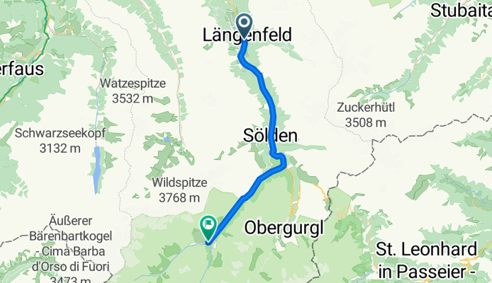
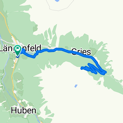
Aquadome nach Vent
A cycling route starting in Umhausen, Tyrol, Austria.
Overview
About this route
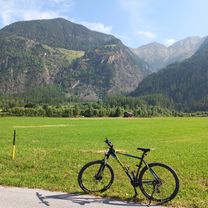
<p>Asphalt or often alternatives to the main road available. Partly trails, or former main routes. Diverse views of wild water and high mountains make the mountain biker sweat with a smile.</p>
Translated, show original (German)- -:--
- Duration
- 30 km
- Distance
- 977 m
- Ascent
- 249 m
- Descent
- ---
- Avg. speed
- ---
- Max. altitude
Route quality
Waytypes & surfaces along the route
Waytypes
Quiet road
8.1 km
(27 %)
Track
7.2 km
(24 %)
Surfaces
Paved
20.1 km
(67 %)
Unpaved
5.7 km
(19 %)
Asphalt
19.5 km
(65 %)
Gravel
4.5 km
(15 %)
Continue with Bikemap
Use, edit, or download this cycling route
You would like to ride Aquadome nach Vent or customize it for your own trip? Here is what you can do with this Bikemap route:
Free features
- Save this route as favorite or in collections
- Copy & plan your own version of this route
- Sync your route with Garmin or Wahoo
Premium features
Free trial for 3 days, or one-time payment. More about Bikemap Premium.
- Navigate this route on iOS & Android
- Export a GPX / KML file of this route
- Create your custom printout (try it for free)
- Download this route for offline navigation
Discover more Premium features.
Get Bikemap PremiumFrom our community
Other popular routes starting in Umhausen
 Via Claudia Augusta 2
- Distance
- 66.7 km
- Ascent
- 1,192 m
- Descent
- 1,691 m
- Location
- Umhausen, Tyrol, Austria
 Nisslalm
- Distance
- 21.1 km
- Ascent
- 873 m
- Descent
- 873 m
- Location
- Umhausen, Tyrol, Austria
 Ötztal Trail / Area 47
- Distance
- 54.8 km
- Ascent
- 576 m
- Descent
- 575 m
- Location
- Umhausen, Tyrol, Austria
 Österreich nach Am Tauferberg 2, Umhausen
- Distance
- 9.6 km
- Ascent
- 123 m
- Descent
- 207 m
- Location
- Umhausen, Tyrol, Austria
 Au to Au 14.08.2025
- Distance
- 56.3 km
- Ascent
- 1,203 m
- Descent
- 1,259 m
- Location
- Umhausen, Tyrol, Austria
 Polltal / Breitlehn
- Distance
- 24.2 km
- Ascent
- 728 m
- Descent
- 728 m
- Location
- Umhausen, Tyrol, Austria
 Längenfeld - Feuerstein
- Distance
- 9.2 km
- Ascent
- 392 m
- Descent
- 42 m
- Location
- Umhausen, Tyrol, Austria
 Sulztal
- Distance
- 20 km
- Ascent
- 730 m
- Descent
- 730 m
- Location
- Umhausen, Tyrol, Austria
Open it in the app