

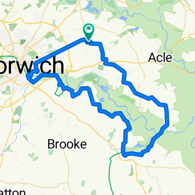
Strumpshaw 5 miles
A cycling route starting in Brundall, England, United Kingdom.
Overview
About this route
park at RSPB
- -:--
- Duration
- 8 km
- Distance
- 59 m
- Ascent
- 59 m
- Descent
- ---
- Avg. speed
- ---
- Max. altitude
Continue with Bikemap
Use, edit, or download this cycling route
You would like to ride Strumpshaw 5 miles or customize it for your own trip? Here is what you can do with this Bikemap route:
Free features
- Save this route as favorite or in collections
- Copy & plan your own version of this route
- Sync your route with Garmin or Wahoo
Premium features
Free trial for 3 days, or one-time payment. More about Bikemap Premium.
- Navigate this route on iOS & Android
- Export a GPX / KML file of this route
- Create your custom printout (try it for free)
- Download this route for offline navigation
Discover more Premium features.
Get Bikemap PremiumFrom our community
Other popular routes starting in Brundall
 Recovered Route
- Distance
- 25 km
- Ascent
- 7 m
- Descent
- 14 m
- Location
- Brundall, England, United Kingdom
 spitfire ninja
- Distance
- 36.6 km
- Ascent
- 87 m
- Descent
- 86 m
- Location
- Brundall, England, United Kingdom
 reedham no.1 route
- Distance
- 60.1 km
- Ascent
- 180 m
- Descent
- 180 m
- Location
- Brundall, England, United Kingdom
 Plumstead Wroxham
- Distance
- 34 km
- Ascent
- 112 m
- Descent
- 111 m
- Location
- Brundall, England, United Kingdom
 23 Highfield Avenue, Norwich to 23 Highfield Avenue, Norwich
- Distance
- 19.9 km
- Ascent
- 109 m
- Descent
- 108 m
- Location
- Brundall, England, United Kingdom
 Main Road-Waxham Road-Wayford Road
- Distance
- 66.6 km
- Ascent
- 96 m
- Descent
- 96 m
- Location
- Brundall, England, United Kingdom
 Plummy-Thorpe
- Distance
- 18.8 km
- Ascent
- 86 m
- Descent
- 86 m
- Location
- Brundall, England, United Kingdom
 Blofield area (10 miles)
- Distance
- 13.8 km
- Ascent
- 75 m
- Descent
- 78 m
- Location
- Brundall, England, United Kingdom
Open it in the app