
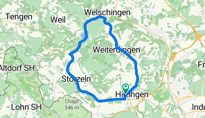
Runde um den Hohenstoffeln
A cycling route starting in Hilzingen, Baden-Württemberg, Germany.
Overview
About this route
Runde um den Hohenstoffeln
- -:--
- Duration
- 20.8 km
- Distance
- 228 m
- Ascent
- 210 m
- Descent
- ---
- Avg. speed
- 542 m
- Max. altitude
Route quality
Waytypes & surfaces along the route
Waytypes
Busy road
10 km
(48 %)
Road
4.9 km
(23 %)
Surfaces
Paved
15.7 km
(76 %)
Unpaved
2.2 km
(11 %)
Asphalt
14.6 km
(70 %)
Unpaved (undefined)
1.3 km
(6 %)
Continue with Bikemap
Use, edit, or download this cycling route
You would like to ride Runde um den Hohenstoffeln or customize it for your own trip? Here is what you can do with this Bikemap route:
Free features
- Save this route as favorite or in collections
- Copy & plan your own version of this route
- Sync your route with Garmin or Wahoo
Premium features
Free trial for 3 days, or one-time payment. More about Bikemap Premium.
- Navigate this route on iOS & Android
- Export a GPX / KML file of this route
- Create your custom printout (try it for free)
- Download this route for offline navigation
Discover more Premium features.
Get Bikemap PremiumFrom our community
Other popular routes starting in Hilzingen
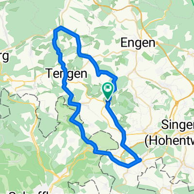 Binningen - Leipferdingen - Tengen - Bibertal - Gottmadingen - Binningen
- Distance
- 47.1 km
- Ascent
- 538 m
- Descent
- 538 m
- Location
- Hilzingen, Baden-Württemberg, Germany
 Hilzingen, Wutachtal, Schwarzwaldpanoramastraße, Klettgau, Rhein CLONED FROM ROUTE 111674
- Distance
- 142.6 km
- Ascent
- 1,261 m
- Descent
- 1,261 m
- Location
- Hilzingen, Baden-Württemberg, Germany
 Nordseite des Schienerberges
- Distance
- 51.6 km
- Ascent
- 1,121 m
- Descent
- 1,121 m
- Location
- Hilzingen, Baden-Württemberg, Germany
 Um den Hohenstoffeln (kleine Tour)
- Distance
- 16.4 km
- Ascent
- 190 m
- Descent
- 148 m
- Location
- Hilzingen, Baden-Württemberg, Germany
 Hilzingen MTB Stauffen
- Distance
- 8.5 km
- Ascent
- 289 m
- Descent
- 290 m
- Location
- Hilzingen, Baden-Württemberg, Germany
 Runde um den Hohenstoffeln
- Distance
- 20.8 km
- Ascent
- 228 m
- Descent
- 210 m
- Location
- Hilzingen, Baden-Württemberg, Germany
 Kleine Rundtour
- Distance
- 25 km
- Ascent
- 300 m
- Descent
- 278 m
- Location
- Hilzingen, Baden-Württemberg, Germany
 Schlatt a. R. - Iznang - Allensbach und zurück
- Distance
- 40.6 km
- Ascent
- 122 m
- Descent
- 243 m
- Location
- Hilzingen, Baden-Württemberg, Germany
Open it in the app