

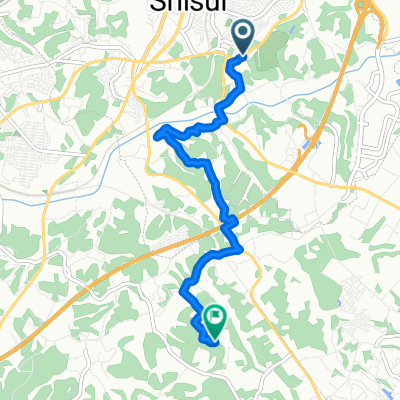
勝間田の池(「佐倉を巡る」)
A cycling route starting in Shisui, Chiba, Japan.
Overview
About this route
- -:--
- Duration
- 6.9 km
- Distance
- 68 m
- Ascent
- 52 m
- Descent
- ---
- Avg. speed
- ---
- Max. altitude

Continue with Bikemap
Use, edit, or download this cycling route
You would like to ride 勝間田の池(「佐倉を巡る」) or customize it for your own trip? Here is what you can do with this Bikemap route:
Free features
- Save this route as favorite or in collections
- Copy & plan your own version of this route
- Sync your route with Garmin or Wahoo
Premium features
Free trial for 3 days, or one-time payment. More about Bikemap Premium.
- Navigate this route on iOS & Android
- Export a GPX / KML file of this route
- Create your custom printout (try it for free)
- Download this route for offline navigation
Discover more Premium features.
Get Bikemap PremiumFrom our community
Other popular routes starting in Shisui
 NATURE-ENOKIDO-MONOI
- Distance
- 25.3 km
- Ascent
- 156 m
- Descent
- 186 m
- Location
- Shisui, Chiba, Japan
 1301 Katsumatanoike (Katsumata Pond)
- Distance
- 6.9 km
- Ascent
- 71 m
- Descent
- 55 m
- Location
- Shisui, Chiba, Japan
 ChibaSatoyamaCycling-Kinoya-Katsumatanoike
- Distance
- 6 km
- Ascent
- 102 m
- Descent
- 104 m
- Location
- Shisui, Chiba, Japan
 酒々井から成田へ
- Distance
- 11.6 km
- Ascent
- 105 m
- Descent
- 104 m
- Location
- Shisui, Chiba, Japan
 NATURE-SHISUI (SOUTH)
- Distance
- 17.4 km
- Ascent
- 183 m
- Descent
- 182 m
- Location
- Shisui, Chiba, Japan
 1400 Shisui
- Distance
- 22.4 km
- Ascent
- 166 m
- Descent
- 164 m
- Location
- Shisui, Chiba, Japan
 勝間田の池(「佐倉を巡る」)
- Distance
- 6.9 km
- Ascent
- 68 m
- Descent
- 52 m
- Location
- Shisui, Chiba, Japan
 かは, 八街は市 までは, 八街市
- Distance
- 39.7 km
- Ascent
- 204 m
- Descent
- 148 m
- Location
- Shisui, Chiba, Japan
Open it in the app