

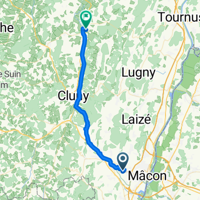
Stage 8 - TDF 2019 - GTP
A cycling route starting in Charnay-lès-Mâcon, Bourgogne-Franche-Comté, France.
Overview
About this route
- -:--
- Duration
- 200.4 km
- Distance
- 2,661 m
- Ascent
- 2,362 m
- Descent
- ---
- Avg. speed
- ---
- Max. altitude

Route quality
Waytypes & surfaces along the route
Waytypes
Road
76.1 km
(38 %)
Quiet road
20 km
(10 %)
Surfaces
Paved
74.1 km
(37 %)
Unpaved
2 km
(1 %)
Asphalt
74.1 km
(37 %)
Ground
2 km
(1 %)
Undefined
124.2 km
(62 %)
Continue with Bikemap
Use, edit, or download this cycling route
You would like to ride Stage 8 - TDF 2019 - GTP or customize it for your own trip? Here is what you can do with this Bikemap route:
Free features
- Save this route as favorite or in collections
- Copy & plan your own version of this route
- Split it into stages to create a multi-day tour
- Sync your route with Garmin or Wahoo
Premium features
Free trial for 3 days, or one-time payment. More about Bikemap Premium.
- Navigate this route on iOS & Android
- Export a GPX / KML file of this route
- Create your custom printout (try it for free)
- Download this route for offline navigation
Discover more Premium features.
Get Bikemap PremiumFrom our community
Other popular routes starting in Charnay-lès-Mâcon
 Charnay-Macon-Saône
- Distance
- 7.3 km
- Ascent
- 34 m
- Descent
- 60 m
- Location
- Charnay-lès-Mâcon, Bourgogne-Franche-Comté, France
 FUISSE
- Distance
- 46.8 km
- Ascent
- 702 m
- Descent
- 702 m
- Location
- Charnay-lès-Mâcon, Bourgogne-Franche-Comté, France
 De Rond-Point du Pôle Santé, Mâcon à 9 Impasse Bellevue, Mâcon
- Distance
- 31.2 km
- Ascent
- 459 m
- Descent
- 471 m
- Location
- Charnay-lès-Mâcon, Bourgogne-Franche-Comté, France
 569 Rue Paul Gauguin, Mâcon à 1382 Rue du Beaujolais, Mâcon
- Distance
- 0.1 km
- Ascent
- 0 m
- Descent
- 0 m
- Location
- Charnay-lès-Mâcon, Bourgogne-Franche-Comté, France
 Chemin de Verneuil, Prissé nach Route de Chissey, Cormatin
- Distance
- 33.7 km
- Ascent
- 391 m
- Descent
- 392 m
- Location
- Charnay-lès-Mâcon, Bourgogne-Franche-Comté, France
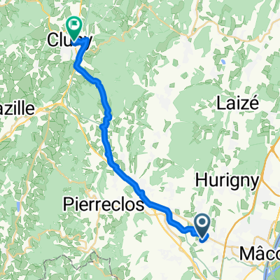 Chemin de Verneuil, Prissé nach Cluny
- Distance
- 21.5 km
- Ascent
- 354 m
- Descent
- 325 m
- Location
- Charnay-lès-Mâcon, Bourgogne-Franche-Comté, France
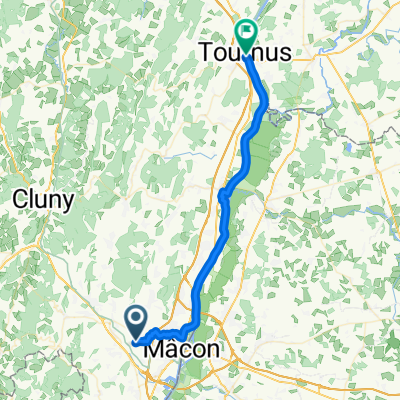 Chemin de Verneuil, Charnay-lès-Mâcon nach Place de l'Hôtel de Ville, Tournus
- Distance
- 38.1 km
- Ascent
- 134 m
- Descent
- 162 m
- Location
- Charnay-lès-Mâcon, Bourgogne-Franche-Comté, France
 Macon-Paray-le-Monial
- Distance
- 101.4 km
- Ascent
- 696 m
- Descent
- 681 m
- Location
- Charnay-lès-Mâcon, Bourgogne-Franche-Comté, France
Open it in the app