

Erkundung Zunzgen-Gisiberg-Diegten-Zunzgerhard-Zunzgen
A cycling route starting in Zunzgen, Basel-Landschaft, Switzerland.
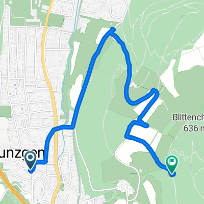
Overview
About this route
- 1 h 18 min
- Duration
- 19.7 km
- Distance
- 667 m
- Ascent
- 816 m
- Descent
- 15.2 km/h
- Avg. speed
- ---
- Max. altitude

Route photos

Route quality
Waytypes & surfaces along the route
Waytypes
Track
8.5 km
(43 %)
Quiet road
6.7 km
(34 %)
Surfaces
Paved
11.6 km
(59 %)
Unpaved
7.7 km
(39 %)
Paved (undefined)
8.1 km
(41 %)
Gravel
5.5 km
(28 %)
Continue with Bikemap
Use, edit, or download this cycling route
You would like to ride Erkundung Zunzgen-Gisiberg-Diegten-Zunzgerhard-Zunzgen or customize it for your own trip? Here is what you can do with this Bikemap route:
Free features
- Save this route as favorite or in collections
- Copy & plan your own version of this route
- Sync your route with Garmin or Wahoo
Premium features
Free trial for 3 days, or one-time payment. More about Bikemap Premium.
- Navigate this route on iOS & Android
- Export a GPX / KML file of this route
- Create your custom printout (try it for free)
- Download this route for offline navigation
Discover more Premium features.
Get Bikemap PremiumFrom our community
Other popular routes starting in Zunzgen
 Thürnen-Gisiberg
- Distance
- 15.7 km
- Ascent
- 347 m
- Descent
- 350 m
- Location
- Zunzgen, Basel-Landschaft, Switzerland
 Zunzgen nach Lausen und Zurück
- Distance
- 12 km
- Ascent
- 121 m
- Descent
- 112 m
- Location
- Zunzgen, Basel-Landschaft, Switzerland
 BS Sissach Basel Lörrach Rheinfelden Sissach
- Distance
- 69.4 km
- Ascent
- 276 m
- Descent
- 394 m
- Location
- Zunzgen, Basel-Landschaft, Switzerland
 Tennikerfluh
- Distance
- 16.8 km
- Ascent
- 360 m
- Descent
- 365 m
- Location
- Zunzgen, Basel-Landschaft, Switzerland
 BS Zunzgen - Reigoldswil - Zunzgen gekürzt
- Distance
- 80.9 km
- Ascent
- 673 m
- Descent
- 673 m
- Location
- Zunzgen, Basel-Landschaft, Switzerland
 GPOB
GPOB- Distance
- 7.9 km
- Ascent
- 183 m
- Descent
- 184 m
- Location
- Zunzgen, Basel-Landschaft, Switzerland
 Route im Schneckentempo in Zunzgen
- Distance
- 2.7 km
- Ascent
- 173 m
- Descent
- 18 m
- Location
- Zunzgen, Basel-Landschaft, Switzerland
 Diegtertal-Tour
- Distance
- 32.8 km
- Ascent
- 1,111 m
- Descent
- 1,108 m
- Location
- Zunzgen, Basel-Landschaft, Switzerland
Open it in the app