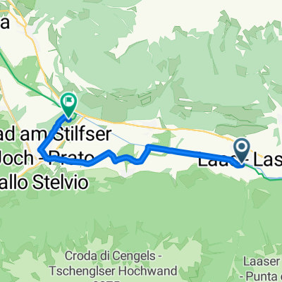
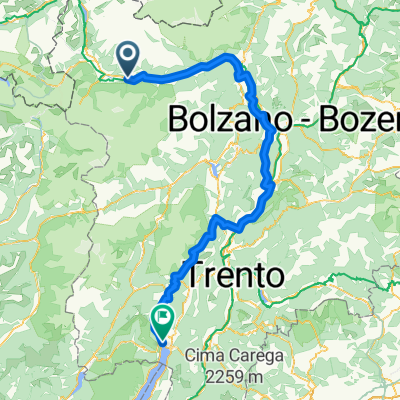
Oris-STÉLVIO (face 1)-Bormio-STÉLVIO (face 2)
A cycling route starting in Laas, Trentino-Alto Adige, Italy.
Overview
About this route
- -:--
- Duration
- 73.6 km
- Distance
- 3,401 m
- Ascent
- 1,534 m
- Descent
- ---
- Avg. speed
- ---
- Max. altitude
Route quality
Waytypes & surfaces along the route
Waytypes
Busy road
67 km
(91 %)
Quiet road
3.2 km
(4 %)
Surfaces
Paved
72.4 km
(98 %)
Unpaved
0.3 km
(<1 %)
Asphalt
72.4 km
(98 %)
Gravel
0.2 km
(<1 %)
Continue with Bikemap
Use, edit, or download this cycling route
You would like to ride Oris-STÉLVIO (face 1)-Bormio-STÉLVIO (face 2) or customize it for your own trip? Here is what you can do with this Bikemap route:
Free features
- Save this route as favorite or in collections
- Copy & plan your own version of this route
- Sync your route with Garmin or Wahoo
Premium features
Free trial for 3 days, or one-time payment. More about Bikemap Premium.
- Navigate this route on iOS & Android
- Export a GPX / KML file of this route
- Create your custom printout (try it for free)
- Download this route for offline navigation
Discover more Premium features.
Get Bikemap PremiumFrom our community
Other popular routes starting in Laas
- Laas - Stelvio
- Distance
- 34.5 km
- Ascent
- 1,970 m
- Descent
- 73 m
- Location
- Laas, Trentino-Alto Adige, Italy
- Dolomitas 6 Lasa
- Distance
- 69.4 km
- Ascent
- 1,921 m
- Descent
- 1,918 m
- Location
- Laas, Trentino-Alto Adige, Italy
- Laas - Meran
- Distance
- 42.6 km
- Ascent
- 17 m
- Descent
- 621 m
- Location
- Laas, Trentino-Alto Adige, Italy
- Rennradtour Oberstdorf - Gardasee 3. Tag . Latsch - Stilferjoch - Latsch
- Distance
- 93.7 km
- Ascent
- 1,843 m
- Descent
- 2,098 m
- Location
- Laas, Trentino-Alto Adige, Italy
- Stelvio & Di Gavia
- Distance
- 144.9 km
- Ascent
- 3,772 m
- Descent
- 3,979 m
- Location
- Laas, Trentino-Alto Adige, Italy
- Radtag Stilftser Joch
- Distance
- 57.5 km
- Ascent
- 1,337 m
- Descent
- 1,340 m
- Location
- Laas, Trentino-Alto Adige, Italy
- 8 - Italie Camping Badlerhof à Camping Seiser Alm
- Distance
- 94.2 km
- Ascent
- 696 m
- Descent
- 664 m
- Location
- Laas, Trentino-Alto Adige, Italy
- 279. Umbrail-Pass/ Giógo di Sta. Maria/ Wormser Joch und Stè
- Distance
- 79.3 km
- Ascent
- 1,884 m
- Descent
- 1,884 m
- Location
- Laas, Trentino-Alto Adige, Italy
Open it in the app