

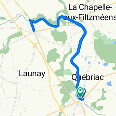
Snail-like route in Tinténiac
A cycling route starting in Tinténiac, Brittany Region, France.
Overview
About this route
- 22 min
- Duration
- 5.6 km
- Distance
- 75 m
- Ascent
- 64 m
- Descent
- 15.3 km/h
- Avg. speed
- ---
- Max. altitude

Route quality
Waytypes & surfaces along the route
Waytypes
Road
5 km
(90 %)
Quiet road
0.3 km
(6 %)
Undefined
0.2 km
(4 %)
Surfaces
Paved
2.4 km
(43 %)
Asphalt
2.4 km
(43 %)
Undefined
3.2 km
(57 %)
Continue with Bikemap
Use, edit, or download this cycling route
You would like to ride Snail-like route in Tinténiac or customize it for your own trip? Here is what you can do with this Bikemap route:
Free features
- Save this route as favorite or in collections
- Copy & plan your own version of this route
- Sync your route with Garmin or Wahoo
Premium features
Free trial for 3 days, or one-time payment. More about Bikemap Premium.
- Navigate this route on iOS & Android
- Export a GPX / KML file of this route
- Create your custom printout (try it for free)
- Download this route for offline navigation
Discover more Premium features.
Get Bikemap PremiumFrom our community
Other popular routes starting in Tinténiac
 Tinténiac - Circuit Duguesclin - 34km
- Distance
- 34.4 km
- Ascent
- 225 m
- Descent
- 225 m
- Location
- Tinténiac, Brittany Region, France
 De Rue du Pont À l'Abbesse 5, Tinténiac à Rue du 8 Mai 1945 9, Tinténiac
- Distance
- 23.2 km
- Ascent
- 97 m
- Descent
- 143 m
- Location
- Tinténiac, Brittany Region, France
 D 20, Tinténiac à 31 ter Place du Guesclin, Dinan
- Distance
- 31 km
- Ascent
- 223 m
- Descent
- 196 m
- Location
- Tinténiac, Brittany Region, France
 1 Quai de la Donac, Tinténiac à 22 Rue St-Malo, Dinan
- Distance
- 32.3 km
- Ascent
- 104 m
- Descent
- 68 m
- Location
- Tinténiac, Brittany Region, France
 Tinteniac-Loudeac variante
- Distance
- 87.4 km
- Ascent
- 491 m
- Descent
- 396 m
- Location
- Tinténiac, Brittany Region, France
 h
h- Distance
- 3.1 km
- Ascent
- 81 m
- Descent
- 16 m
- Location
- Tinténiac, Brittany Region, France
 Tinténiac à 2 La Petite Magdeleine, Hédé-Bazouges
- Distance
- 5.3 km
- Ascent
- 15 m
- Descent
- 3 m
- Location
- Tinténiac, Brittany Region, France
 De Rue du Pont À l'Abbesse 2, Tinténiac à Rue du 8 Mai 1945 9, Tinténiac
- Distance
- 24 km
- Ascent
- 149 m
- Descent
- 204 m
- Location
- Tinténiac, Brittany Region, France
Open it in the app