

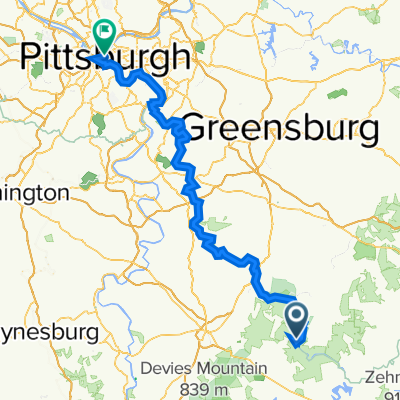
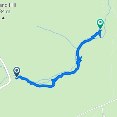
Ohiopyle to confluence
A cycling route starting in Dunbar, Pennsylvania, United States.
Overview
About this route
- 1 h 36 min
- Duration
- 17.5 km
- Distance
- 44 m
- Ascent
- 19 m
- Descent
- 10.9 km/h
- Avg. speed
- ---
- Max. altitude

Route quality
Waytypes & surfaces along the route
Waytypes
Cycleway
16.8 km
(96 %)
Quiet road
0.7 km
(4 %)
Surfaces
Paved
1 km
(6 %)
Unpaved
15.7 km
(90 %)
Loose gravel
15.7 km
(90 %)
Paved (undefined)
1 km
(6 %)
Undefined
0.7 km
(4 %)
Continue with Bikemap
Use, edit, or download this cycling route
You would like to ride Ohiopyle to confluence or customize it for your own trip? Here is what you can do with this Bikemap route:
Free features
- Save this route as favorite or in collections
- Copy & plan your own version of this route
- Sync your route with Garmin or Wahoo
Premium features
Free trial for 3 days, or one-time payment. More about Bikemap Premium.
- Navigate this route on iOS & Android
- Export a GPX / KML file of this route
- Create your custom printout (try it for free)
- Download this route for offline navigation
Discover more Premium features.
Get Bikemap PremiumFrom our community
Other popular routes starting in Dunbar
 Ohiopyle
- Distance
- 25.3 km
- Ascent
- 1,126 m
- Descent
- 1,126 m
- Location
- Dunbar, Pennsylvania, United States
 Gap Trail Day 5
- Distance
- 126.7 km
- Ascent
- 1,380 m
- Descent
- 1,614 m
- Location
- Dunbar, Pennsylvania, United States
 Steady ride in 2waAqAQ22wqwaaq
- Distance
- 1.7 km
- Ascent
- 20 m
- Descent
- 53 m
- Location
- Dunbar, Pennsylvania, United States
 Four ridge route out of Ohiopyle
- Distance
- 103.8 km
- Ascent
- 1,863 m
- Descent
- 1,857 m
- Location
- Dunbar, Pennsylvania, United States
 Holland Hill Road, Dunbar to Holland Hill Road, Dunbar
- Distance
- 0 km
- Ascent
- 5 m
- Descent
- 0 m
- Location
- Dunbar, Pennsylvania, United States
 Second Stage -> Ohiopyle - Cumberland
- Distance
- 118.4 km
- Ascent
- 449 m
- Descent
- 623 m
- Location
- Dunbar, Pennsylvania, United States
 Ohiopyle to confluence
- Distance
- 17.5 km
- Ascent
- 44 m
- Descent
- 19 m
- Location
- Dunbar, Pennsylvania, United States
 Aug 22, 2015, 1:45 PM
- Distance
- 30.3 km
- Ascent
- 391 m
- Descent
- 376 m
- Location
- Dunbar, Pennsylvania, United States
Open it in the app