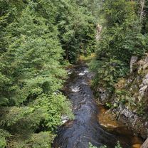
Mosel Oberlauf, Saarbrücken, Strassburg
A cycling route starting in Saint-Maurice-sur-Moselle, Grand Est, France.
Overview
About this route
- -:--
- Duration
- 641.1 km
- Distance
- 3,497 m
- Ascent
- 3,505 m
- Descent
- ---
- Avg. speed
- 774 m
- Max. altitude
Route quality
Waytypes & surfaces along the route
Waytypes
Cycleway
153.9 km
(24 %)
Path
141 km
(22 %)
Surfaces
Paved
512.9 km
(80 %)
Unpaved
19.2 km
(3 %)
Asphalt
429.5 km
(67 %)
Paved (undefined)
64.1 km
(10 %)
Route highlights
Points of interest along the route
Point of interest after 34 km
Club du Soleil Mulhouse
Point of interest after 44.5 km
4 Camping
Point of interest after 61.9 km
Camping Municipal Alsacia
Point of interest after 72.5 km
Camping Three Castles
Point of interest after 76.1 km
Kempf Marc
Point of interest after 82.1 km
Camping Kaysersberg
Point of interest after 210 km
4 Camping
Point of interest after 232.7 km
Camping Camp Municipal Le Lac Vert
Point of interest after 241.5 km
Centre de loisirs "les Sapins" Camping municipal 3*
Point of interest after 245.6 km
Camping de l'étang
Point of interest after 277.3 km
4 Camping
Point of interest after 321 km
2 Camping
Point of interest after 332.3 km
2 Camping
Point of interest after 385.2 km
3 Camping
Point of interest after 396.6 km
2 Camping
Point of interest after 416.9 km
Camping Municipal Metz
Point of interest after 432.2 km
Camping Paquis Corny
Point of interest after 509.4 km
2 Camping
Point of interest after 527 km
2 Camping
Point of interest after 540.4 km
Camping Velle Sur Moselle
Point of interest after 558.7 km
2 Camping
Point of interest after 584.7 km
2 Camping
Point of interest after 620.7 km
Camping Maxonchamp
Point of interest after 634.3 km
Camping Municipal
Point of interest after 641.1 km
Les Acacias
Point of interest after 641.1 km
Camping Des Eurockéennes
Continue with Bikemap
Use, edit, or download this cycling route
You would like to ride Mosel Oberlauf, Saarbrücken, Strassburg or customize it for your own trip? Here is what you can do with this Bikemap route:
Free features
- Save this route as favorite or in collections
- Copy & plan your own version of this route
- Split it into stages to create a multi-day tour
- Sync your route with Garmin or Wahoo
Premium features
Free trial for 3 days, or one-time payment. More about Bikemap Premium.
- Navigate this route on iOS & Android
- Export a GPX / KML file of this route
- Create your custom printout (try it for free)
- Download this route for offline navigation
Discover more Premium features.
Get Bikemap PremiumFrom our community
Other popular routes starting in Saint-Maurice-sur-Moselle
 Planche de belle filles et Ballon d'Alsace
- Distance
- 98.9 km
- Ascent
- 2,335 m
- Descent
- 2,336 m
- Location
- Saint-Maurice-sur-Moselle, Grand Est, France
 Von Saint-Maurice-sur-Moselle zurück nach Remiremont mit Abstecher ins Tal der Moselotte (2024)
- Distance
- 52.6 km
- Ascent
- 65 m
- Descent
- 228 m
- Location
- Saint-Maurice-sur-Moselle, Grand Est, France
 Mosel Oberlauf, Saarbrücken, Strassburg
- Distance
- 641.1 km
- Ascent
- 3,497 m
- Descent
- 3,505 m
- Location
- Saint-Maurice-sur-Moselle, Grand Est, France
 La Goutte du Rieux - Le Grand Ballon
- Distance
- 92.7 km
- Ascent
- 1,655 m
- Descent
- 1,650 m
- Location
- Saint-Maurice-sur-Moselle, Grand Est, France
 Col de Bussang/Le Hockneck (La Schlucht)/Petit Ballon/Platzerwasel (Grand Ballon)/Col du Hundsruck/Ballon d'Alsace
- Distance
- 173.4 km
- Ascent
- 5,201 m
- Descent
- 5,200 m
- Location
- Saint-Maurice-sur-Moselle, Grand Est, France
 Ballon d'alsace - Planche des belles filles - Ballon de Servance
- Distance
- 83.8 km
- Ascent
- 1,806 m
- Descent
- 1,805 m
- Location
- Saint-Maurice-sur-Moselle, Grand Est, France
 Stef@ns Tour zur Tour 2005 Etappe 4 am 10.07.05
- Distance
- 113.2 km
- Ascent
- 637 m
- Descent
- 1,268 m
- Location
- Saint-Maurice-sur-Moselle, Grand Est, France
 Vogesen - Südschlenker Ballon, Servance, Belles Filles
- Distance
- 93 km
- Ascent
- 1,809 m
- Descent
- 1,808 m
- Location
- Saint-Maurice-sur-Moselle, Grand Est, France
Open it in the app


