

Tour de "Myślęcinek"
Tour de Myślęcinek etap 2
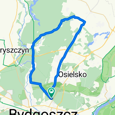
A cycling route starting in Bydgoszcz, Kujawsko-Pomorskie Voivodship, Poland.
Overview
About this route
- -:--
- Duration
- 17 km
- Distance
- 57 m
- Ascent
- 54 m
- Descent
- ---
- Avg. speed
- ---
- Max. altitude

Part of
Tour de "Myślęcinek"
8 stages
Route quality
Waytypes & surfaces along the route
Waytypes
Quiet road
8.4 km
(49 %)
Cycleway
4.6 km
(27 %)
Surfaces
Paved
11.6 km
(68 %)
Unpaved
0.3 km
(2 %)
Asphalt
10.4 km
(61 %)
Paved (undefined)
1.2 km
(7 %)
Continue with Bikemap
Use, edit, or download this cycling route
You would like to ride Tour de Myślęcinek etap 2 or customize it for your own trip? Here is what you can do with this Bikemap route:
Free features
- Save this route as favorite or in collections
- Copy & plan your own version of this route
- Sync your route with Garmin or Wahoo
Premium features
Free trial for 3 days, or one-time payment. More about Bikemap Premium.
- Navigate this route on iOS & Android
- Export a GPX / KML file of this route
- Create your custom printout (try it for free)
- Download this route for offline navigation
Discover more Premium features.
Get Bikemap PremiumFrom our community
Other popular routes starting in Bydgoszcz
 Piecki p.Emilianowo
- Distance
- 26.1 km
- Ascent
- 81 m
- Descent
- 82 m
- Location
- Bydgoszcz, Kujawsko-Pomorskie Voivodship, Poland
 Myslecinek
- Distance
- 11.7 km
- Ascent
- 151 m
- Descent
- 100 m
- Location
- Bydgoszcz, Kujawsko-Pomorskie Voivodship, Poland
 Pętelka Pyszczyn
- Distance
- 38.5 km
- Ascent
- 168 m
- Descent
- 168 m
- Location
- Bydgoszcz, Kujawsko-Pomorskie Voivodship, Poland
 Wokół Zalewu Koronowskiego
- Distance
- 103.9 km
- Ascent
- 215 m
- Descent
- 213 m
- Location
- Bydgoszcz, Kujawsko-Pomorskie Voivodship, Poland
 Dookoła osielska, przez fordon
- Distance
- 53.7 km
- Ascent
- 141 m
- Descent
- 141 m
- Location
- Bydgoszcz, Kujawsko-Pomorskie Voivodship, Poland
 Bydgoszcz Cycling
- Distance
- 30.8 km
- Ascent
- 24 m
- Descent
- 24 m
- Location
- Bydgoszcz, Kujawsko-Pomorskie Voivodship, Poland
 Tour de Myślęcinek etap 3
- Distance
- 15.8 km
- Ascent
- 60 m
- Descent
- 58 m
- Location
- Bydgoszcz, Kujawsko-Pomorskie Voivodship, Poland
 NIEDZIELNY TRENING
- Distance
- 24 km
- Ascent
- 67 m
- Descent
- 69 m
- Location
- Bydgoszcz, Kujawsko-Pomorskie Voivodship, Poland
Open it in the app