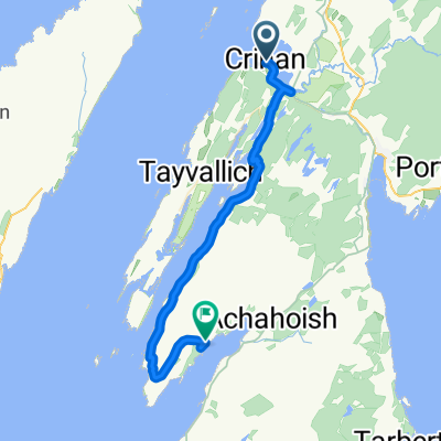
Tag 2 Crinan - Kilmartin
- 37.7 km
- 212 m
- 213 m
- Lochgilphead, Scotland, United Kingdom
A cycling route starting in Lochgilphead, Scotland, United Kingdom.
Overview
created this 6 years ago
Route quality
Road
13.9 km
(37 %)
Cycleway
9.8 km
(26 %)
Paved
10.2 km
(27 %)
Unpaved
9.8 km
(26 %)
Asphalt
10.2 km
(27 %)
Loose gravel
9.8 km
(26 %)
Undefined
17.7 km
(47 %)
Continue with Bikemap
You would like to ride Tag 2 Crinan - Kilmartin or customize it for your own trip? Here is what you can do with this Bikemap route:
Free trial for 3 days, or one-time payment. More about Bikemap Premium.
Discover more Premium features.
Get Bikemap PremiumFrom our community
Open it in the app