

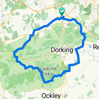
Surrey Hills route
A cycling route starting in Leatherhead, England, United Kingdom.
Overview
About this route
- -:--
- Duration
- 44.9 km
- Distance
- 561 m
- Ascent
- 561 m
- Descent
- ---
- Avg. speed
- ---
- Max. altitude

Route quality
Waytypes & surfaces along the route
Waytypes
Road
24.7 km
(55 %)
Quiet road
12.1 km
(27 %)
Surfaces
Paved
28.3 km
(63 %)
Asphalt
28.3 km
(63 %)
Undefined
16.6 km
(37 %)
Route highlights
Points of interest along the route
Point of interest after 12.6 km
Continue with Bikemap
Use, edit, or download this cycling route
You would like to ride Surrey Hills route or customize it for your own trip? Here is what you can do with this Bikemap route:
Free features
- Save this route as favorite or in collections
- Copy & plan your own version of this route
- Sync your route with Garmin or Wahoo
Premium features
Free trial for 3 days, or one-time payment. More about Bikemap Premium.
- Navigate this route on iOS & Android
- Export a GPX / KML file of this route
- Create your custom printout (try it for free)
- Download this route for offline navigation
Discover more Premium features.
Get Bikemap PremiumFrom our community
Other popular routes starting in Leatherhead
 20K
20K- Distance
- 22.2 km
- Ascent
- 199 m
- Descent
- 197 m
- Location
- Leatherhead, England, United Kingdom
 Home to Brighton
- Distance
- 76.4 km
- Ascent
- 571 m
- Descent
- 624 m
- Location
- Leatherhead, England, United Kingdom
 Leatherhead-Brockham-Abinger-Efingham-Leatherhead
- Distance
- 51.3 km
- Ascent
- 495 m
- Descent
- 501 m
- Location
- Leatherhead, England, United Kingdom
 2009 SWRC Early Spring Cyclosportive
- Distance
- 98.2 km
- Ascent
- 989 m
- Descent
- 972 m
- Location
- Leatherhead, England, United Kingdom
 leatherhead plan 16
- Distance
- 20.7 km
- Ascent
- 393 m
- Descent
- 391 m
- Location
- Leatherhead, England, United Kingdom
 Surrey Hills route
- Distance
- 44.9 km
- Ascent
- 561 m
- Descent
- 561 m
- Location
- Leatherhead, England, United Kingdom
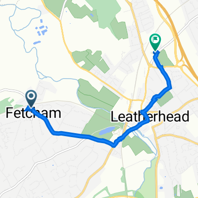 173–177 Cobham Road, Fetcham, Leatherhead to 35 Barnett House, Barnett Close, Leatherhead
- Distance
- 3.9 km
- Ascent
- 35 m
- Descent
- 29 m
- Location
- Leatherhead, England, United Kingdom
 Before or after work ride
- Distance
- 20.1 km
- Ascent
- 283 m
- Descent
- 290 m
- Location
- Leatherhead, England, United Kingdom
Open it in the app