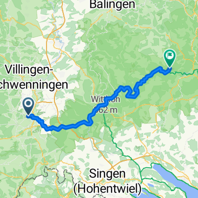
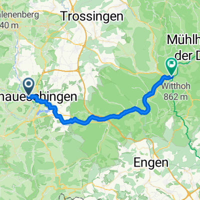
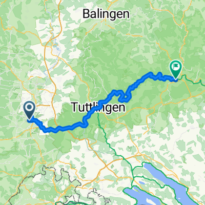
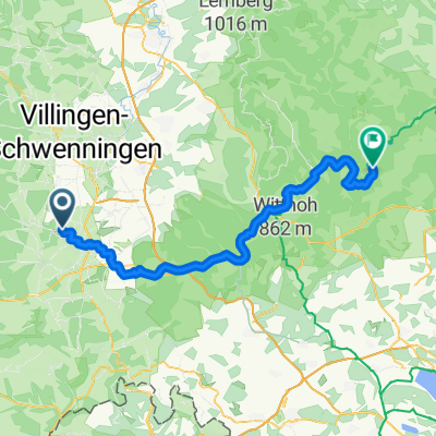
Danube: 1. Donaueschingen to Neumuhl
A cycling route starting in Donaueschingen, Baden-Wurttemberg, Germany.
Overview
About this route
- -:--
- Duration
- 78.3 km
- Distance
- 216 m
- Ascent
- 303 m
- Descent
- ---
- Avg. speed
- ---
- Max. altitude
Route quality
Waytypes & surfaces along the route
Waytypes
Track
42.3 km
(54 %)
Quiet road
10.2 km
(13 %)
Surfaces
Paved
61.8 km
(79 %)
Unpaved
13.3 km
(17 %)
Asphalt
55.6 km
(71 %)
Gravel
9.4 km
(12 %)
Continue with Bikemap
Use, edit, or download this cycling route
You would like to ride Danube: 1. Donaueschingen to Neumuhl or customize it for your own trip? Here is what you can do with this Bikemap route:
Free features
- Save this route as favorite or in collections
- Copy & plan your own version of this route
- Sync your route with Garmin or Wahoo
Premium features
Free trial for 3 days, or one-time payment. More about Bikemap Premium.
- Navigate this route on iOS & Android
- Export a GPX / KML file of this route
- Create your custom printout (try it for free)
- Download this route for offline navigation
Discover more Premium features.
Get Bikemap PremiumFrom our community
Other popular routes starting in Donaueschingen
- Donautal
- Distance
- 52.4 km
- Ascent
- 316 m
- Descent
- 321 m
- Location
- Donaueschingen, Baden-Wurttemberg, Germany
- Donauradweg
- Distance
- 86.1 km
- Ascent
- 246 m
- Descent
- 370 m
- Location
- Donaueschingen, Baden-Wurttemberg, Germany
- Die Donaueschingen-Siofók-Hypothese
- Distance
- 1,220.5 km
- Ascent
- 115 m
- Descent
- 680 m
- Location
- Donaueschingen, Baden-Wurttemberg, Germany
- 31km-DonauEntspring Donaueschingen
- Distance
- 31.3 km
- Ascent
- 180 m
- Descent
- 181 m
- Location
- Donaueschingen, Baden-Wurttemberg, Germany
- Donauradweg (Donaueschingen - Wien)
- Distance
- 969.6 km
- Ascent
- 199 m
- Descent
- 722 m
- Location
- Donaueschingen, Baden-Wurttemberg, Germany
- Donautour 1.Etappe
- Distance
- 99.3 km
- Ascent
- 311 m
- Descent
- 407 m
- Location
- Donaueschingen, Baden-Wurttemberg, Germany
- Der Donauradweg
- Distance
- 622.8 km
- Ascent
- 3,031 m
- Descent
- 3,406 m
- Location
- Donaueschingen, Baden-Wurttemberg, Germany
- Donauradweg
- Distance
- 984.1 km
- Ascent
- 267 m
- Descent
- 552 m
- Location
- Donaueschingen, Baden-Wurttemberg, Germany
Open it in the app