

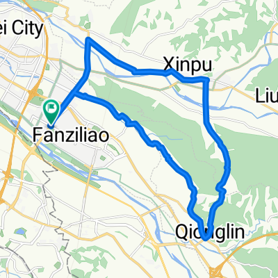
中等路線 竹北市夜騎路線
A cycling route starting in Zhubei, Taiwan, Taiwan.
Overview
About this route
- 1 h 42 min
- Duration
- 23.2 km
- Distance
- 187 m
- Ascent
- 183 m
- Descent
- 13.7 km/h
- Avg. speed
- ---
- Max. altitude

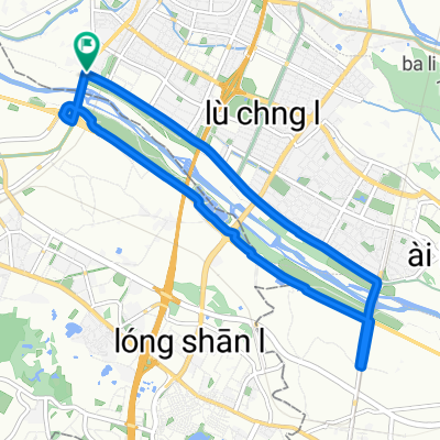
Route photos


Route quality
Waytypes & surfaces along the route
Waytypes
Road
7.2 km
(31 %)
Quiet road
3.7 km
(16 %)
Surfaces
Paved
8.6 km
(37 %)
Asphalt
8.6 km
(37 %)
Undefined
14.6 km
(63 %)
Continue with Bikemap
Use, edit, or download this cycling route
You would like to ride 中等路線 竹北市夜騎路線 or customize it for your own trip? Here is what you can do with this Bikemap route:
Free features
- Save this route as favorite or in collections
- Copy & plan your own version of this route
- Sync your route with Garmin or Wahoo
Premium features
Free trial for 3 days, or one-time payment. More about Bikemap Premium.
- Navigate this route on iOS & Android
- Export a GPX / KML file of this route
- Create your custom printout (try it for free)
- Download this route for offline navigation
Discover more Premium features.
Get Bikemap PremiumFrom our community
Other popular routes starting in Zhubei
 新竹新埔、芎林,田園路線
- Distance
- 24.2 km
- Ascent
- 148 m
- Descent
- 149 m
- Location
- Zhubei, Taiwan, Taiwan
 1st Fun Biker Taiwan Cycling Activity
- Distance
- 988.8 km
- Ascent
- 1,413 m
- Descent
- 1,419 m
- Location
- Zhubei, Taiwan, Taiwan
 好久沒有騎這麼遠了!
- Distance
- 37.6 km
- Ascent
- 219 m
- Descent
- 239 m
- Location
- Zhubei, Taiwan, Taiwan
 中等路線 竹北市夜騎路線
- Distance
- 23.2 km
- Ascent
- 187 m
- Descent
- 183 m
- Location
- Zhubei, Taiwan, Taiwan
 FormFactor Cycling Taiwan Plan
- Distance
- 930.1 km
- Ascent
- 1,919 m
- Descent
- 1,918 m
- Location
- Zhubei, Taiwan, Taiwan
 Hukou_1
- Distance
- 21.6 km
- Ascent
- 320 m
- Descent
- 323 m
- Location
- Zhubei, Taiwan, Taiwan
 Route in Zhubei City
- Distance
- 13.2 km
- Ascent
- 57 m
- Descent
- 59 m
- Location
- Zhubei, Taiwan, Taiwan
 yangmei tea ride
- Distance
- 22.8 km
- Ascent
- 669 m
- Descent
- 639 m
- Location
- Zhubei, Taiwan, Taiwan
Open it in the app