

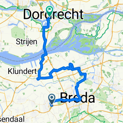
Hollandia
A cycling route starting in Breda, North Brabant, The Netherlands.
Overview
About this route
- -:--
- Duration
- 238.1 km
- Distance
- 28 m
- Ascent
- 29 m
- Descent
- ---
- Avg. speed
- ---
- Max. altitude
Route quality
Waytypes & surfaces along the route
Waytypes
Cycleway
126.2 km
(53 %)
Quiet road
83.3 km
(35 %)
Surfaces
Paved
150 km
(63 %)
Unpaved
4.8 km
(2 %)
Asphalt
121.4 km
(51 %)
Concrete
23.8 km
(10 %)
Route highlights
Points of interest along the route

Photo after 9 km
A Rotterdami kikötőt, a Spido hajóval lehet megtekinteni, ami az Erasmus hídtól indul.

Photo after 24.2 km
Madurodam

Photo after 24.2 km
Kinderdijk. Itt vannak legnagyobb számban a szélmalmok.

Photo after 34.4 km
Efteling a Holland Disniland.

Photo after 45.1 km
Leiden, a csatornák.

Photo after 60 km
Keukenhof park.

Photo after 86 km
Amsterdam, csatornák.

Photo after 86.6 km
Haarlem

Photo after 87.7 km
Vízi-biciklizés Amsterdamban

Photo after 96.3 km
Vondelpark

Photo after 102.5 km
Naarden

Photo after 102.5 km
Muiderslot várkastély

Photo after 126.4 km
Zaanse Schans Vízimalmok és skanzen.

Photo after 175 km
Paleis Het Loo kastélypark

Photo after 223 km
Giethoorn. Észak Velencéje.
Continue with Bikemap
Use, edit, or download this cycling route
You would like to ride Hollandia or customize it for your own trip? Here is what you can do with this Bikemap route:
Free features
- Save this route as favorite or in collections
- Copy & plan your own version of this route
- Split it into stages to create a multi-day tour
- Sync your route with Garmin or Wahoo
Premium features
Free trial for 3 days, or one-time payment. More about Bikemap Premium.
- Navigate this route on iOS & Android
- Export a GPX / KML file of this route
- Create your custom printout (try it for free)
- Download this route for offline navigation
Discover more Premium features.
Get Bikemap PremiumFrom our community
Other popular routes starting in Breda
 Ten zuiden van Breda
- Distance
- 49.3 km
- Ascent
- 37 m
- Descent
- 36 m
- Location
- Breda, North Brabant, The Netherlands
 Groot Rondje Breda
- Distance
- 81.7 km
- Ascent
- 41 m
- Descent
- 40 m
- Location
- Breda, North Brabant, The Netherlands
 Hoogstraten - Seneffe
- Distance
- 189.1 km
- Ascent
- 555 m
- Descent
- 431 m
- Location
- Breda, North Brabant, The Netherlands
 Mon 9.1 Breda to Utrecht
- Distance
- 84 km
- Ascent
- 81 m
- Descent
- 78 m
- Location
- Breda, North Brabant, The Netherlands
 rondje Rijsbergen, Ginderdoor, Dassemus
- Distance
- 44.3 km
- Ascent
- 51 m
- Descent
- 51 m
- Location
- Breda, North Brabant, The Netherlands
 Breda - Nieuwegein
- Distance
- 89.9 km
- Ascent
- 48 m
- Descent
- 50 m
- Location
- Breda, North Brabant, The Netherlands
 fiets weer eens uit het vet gehaald Route
- Distance
- 14.3 km
- Ascent
- 0 m
- Descent
- 3 m
- Location
- Breda, North Brabant, The Netherlands
 19. nap Etten-Leur–Breda–Dordrecht
- Distance
- 67.7 km
- Ascent
- 61 m
- Descent
- 61 m
- Location
- Breda, North Brabant, The Netherlands
Open it in the app