Dankmarshausen - Lauterbach / Hessen
- 93.7 km
- 838 m
- 639 m
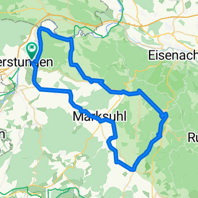
- Gerstungen, Thuringia, Germany
A cycling route starting in Gerstungen, Thuringia, Germany.
Overview
created this 6 years ago
Route quality
Road
10.6 km
(39 %)
Track
6 km
(22 %)
Paved
19.8 km
(73 %)
Unpaved
4.1 km
(15 %)
Asphalt
19.8 km
(73 %)
Gravel
4.1 km
(15 %)
Undefined
3.3 km
(12 %)
Continue with Bikemap
You would like to ride 08.08.2019 Gerstungen - Eisenach or customize it for your own trip? Here is what you can do with this Bikemap route:
Free trial for 3 days, or one-time payment. More about Bikemap Premium.
Discover more Premium features.
Get Bikemap PremiumFrom our community
Open it in the app